
ଫାଇଲ:Vardah 2016-12-11 0515Z.jpg

ଏହି ଦେଖଣାର ଆକାର: ୪୫୦ × ୬୦୦ ପିକ୍ସେଲ । ବାକି ରେଜୋଲୁସନ: ୧୮୦ × ୨୪୦ ପିକ୍ସେଲ | ୩୬୦ × ୪୮୦ ପିକ୍ସେଲ | ୫୭୬ × ୭୬୮ ପିକ୍ସେଲ | ୭୬୮ × ୧,୦୨୪ ପିକ୍ସେଲ | ୧,୫୩୬ × ୨,୦୪୮ ପିକ୍ସେଲ | ୫,୧୯୦ × ୬,୯୨୦ ପିକ୍ସେଲ.
ମୂଳ ଫାଇଲ (୫,୧୯୦ × ୬,୯୨୦ ପିକସେଲ, ଫାଇଲ ଆକାର: ୮.୯୭ MB, ଏମ.ଆଇ.ଏମ.ଇର ପ୍ରକାର: image/jpeg)
This is a file from the Wikimedia Commons. Information from its description page there is shown below. |
ସାରକଥା
| ବିବରଣୀ |
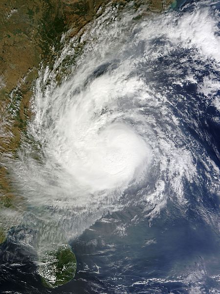
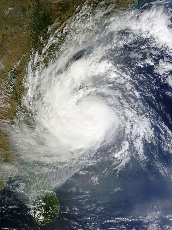
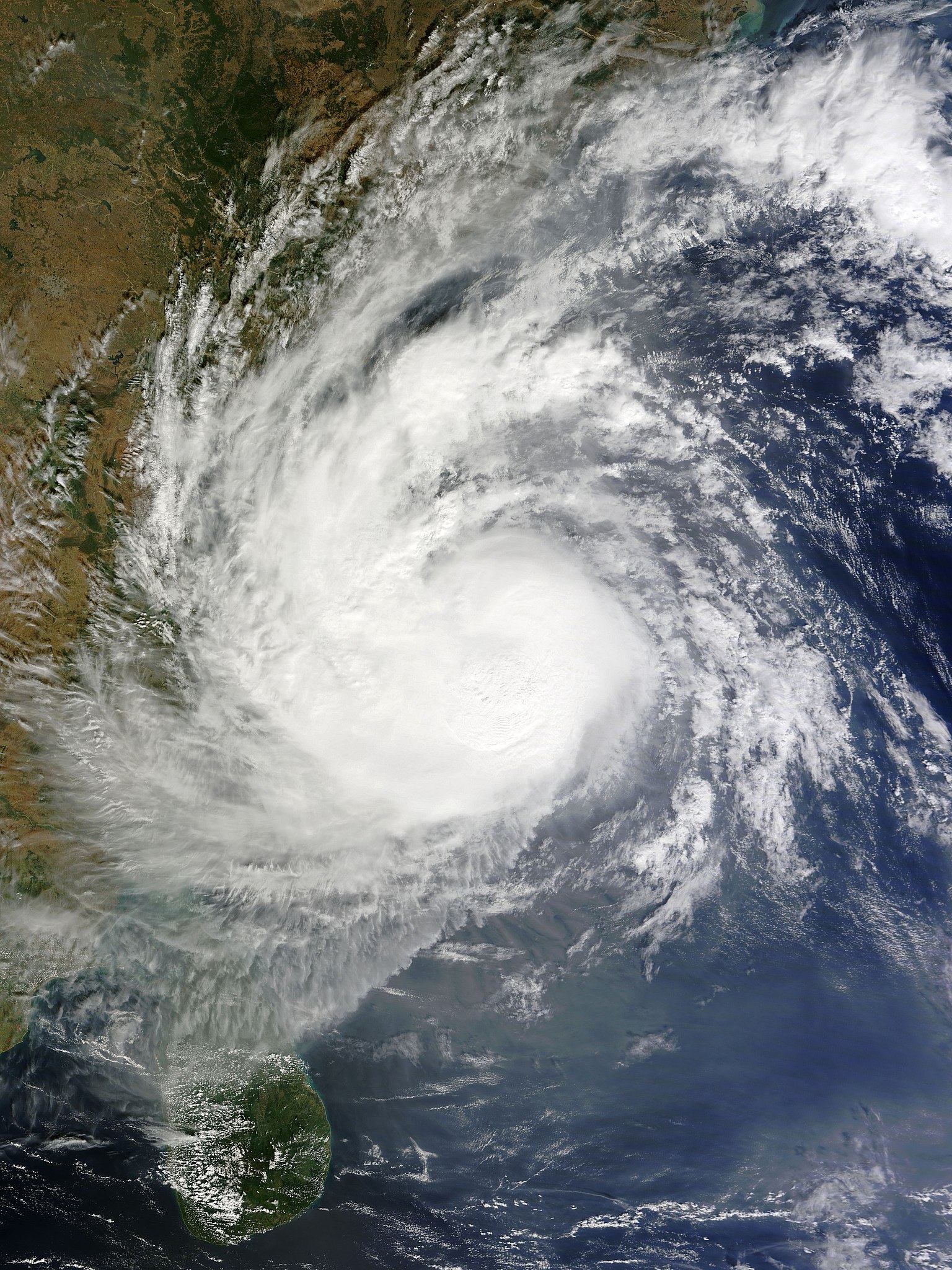
English: Very Severe Cyclonic Storm Vardah at peak intensity and approaching South India on 11 December 2016. |
| ତାରିଖ | |
| ମୂଳାଧାର | EOSDIS Worldview |
| ଲେଖକ | MODIS image captured by NASA’s Terra satellite |
| Camera location | | View this and other nearby images on: OpenStreetMap |
|---|
ସତ୍ଵ
| This file is in the public domain in the United States because it was solely created by NASA. NASA copyright policy states that "NASA material is not protected by copyright unless noted". (See Template:PD-USGov, NASA copyright policy page or JPL Image Use Policy.) | ||
 |
Warnings:
|
ଫାଇଲ ଇତିହାସ
ଏହା ଫାଇଲଟି ସେତେବେଳେ ଯେମିତି ଦିଶୁଥିଲା ତାହା ଦେଖିବା ପାଇଁ ତାରିଖ/ବେଳା ଉପରେ କ୍ଲିକ କରନ୍ତୁ
| ତାରିଖ/ବେଳ | ନଖ ଦେଖଣା | ଆକାର | ବ୍ୟବହାରକାରୀ | ମତାମତ | |
|---|---|---|---|---|---|
| ଏବେକାର | ୨୦:୦୮, ୧୧ ଡିସେମ୍ବର ୨୦୧୬ | | ୫,୧୯୦ × ୬,୯୨୦ (୮.୯୭ MB) | Meow | Optimised with a better ratio. |
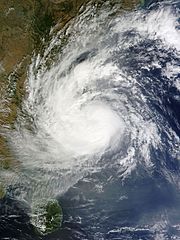
| ୧୫:୦୨, ୧୧ ଡିସେମ୍ବର ୨୦୧୬ |  | ୧,୫୨୦ × ୧,୯୦୪ (୪୪୬ KB) | Typhoon2013 | User created page with UploadWizard |
ଫାଇଲ ବ୍ୟବହାର
ଏହି ସବୁପୃଷ୍ଠା ଏହି ଫାଇଲଟିକୁ ଯୋଡ଼ିଥାନ୍ତି:
ଜଗତ ଫାଇଲ ବ୍ୟବହାର
ତଳଲିଖିତ ଉଇକିସବୁ ଏହି ଫାଇଲଟିକୁ ବ୍ୟବହାର କରିଥାନ୍ତି:
- en.wikipedia.orgରେ ବ୍ୟବହାର
- es.wikipedia.orgରେ ବ୍ୟବହାର
- fr.wikipedia.orgରେ ବ୍ୟବହାର
- hi.wikipedia.orgରେ ବ୍ୟବହାର
- ko.wikipedia.orgରେ ବ୍ୟବହାର
- ml.wikipedia.orgରେ ବ୍ୟବହାର
- ta.wikipedia.orgରେ ବ୍ୟବହାର
- th.wikipedia.orgରେ ବ୍ୟବହାର
- www.wikidata.orgରେ ବ୍ୟବହାର
- zh.wikipedia.orgରେ ବ୍ୟବହାର