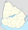
ଫାଇଲ:Uruguay location map.svg

Size of this PNG preview of this SVG file: ୫୫୦ × ୬୦୦ ପିକ୍ସେଲ. ବାକି ରେଜୋଲୁସନ: ୨୨୦ × ୨୪୦ ପିକ୍ସେଲ | ୪୪୦ × ୪୮୦ ପିକ୍ସେଲ | ୭୦୫ × ୭୬୮ ପିକ୍ସେଲ | ୯୩୯ × ୧,୦୨୪ ପିକ୍ସେଲ | ୧,୮୭୯ × ୨,୦୪୮ ପିକ୍ସେଲ | ୧,୦୦୦ × ୧,୦୯୦ ପିକ୍ସେଲ.
ମୂଳ ଫାଇଲ (SVG ଫାଇଲ, ସାଧାରଣ ମାପ ୧,୦୦୦ × ୧,୦୯୦ ପିକ୍ସେଲ, ଫାଇଲ ଆକାର: ୬୨ KB)
ଫାଇଲ ଇତିହାସ
ଏହା ଫାଇଲଟି ସେତେବେଳେ ଯେମିତି ଦିଶୁଥିଲା ତାହା ଦେଖିବା ପାଇଁ ତାରିଖ/ବେଳା ଉପରେ କ୍ଲିକ କରନ୍ତୁ
| ତାରିଖ/ବେଳ | ନଖ ଦେଖଣା | ଆକାର | ବ୍ୟବହାରକାରୀ | ମତାମତ | |
|---|---|---|---|---|---|
| ଏବେକାର | ୧୧:୧୩, ୧୬ ମାର୍ଚ୍ଚ ୨୦୨୪ |  | ୧,୦୦୦ × ୧,୦୯୦ (୬୨ KB) | GrandEscogriffe | more correct north-south stretching |
| ୦୭:୧୩, ୧୩ ଜୁଲାଇ ୨୦୧୬ |  | ୧,୦୦୦ × ୧,୦୫୬ (୭୪ KB) | Janitoalevic | Added Rincón de Artigas and isla Brasilera disputes and fixed brazilian border in the north of the map. | |
| ୧୯:୪୯, ୧୦ ଫେବୃଆରୀ ୨୦୧୧ |  | ୧,୦୦୦ × ୧,୦୫୬ (୭୭ KB) | Antonsusi | ... | |
| ୧୯:୪୨, ୧୦ ଫେବୃଆରୀ ୨୦୧୧ |  | ୧,୦୦୦ × ୧,୦୫୬ (୭୭ KB) | Antonsusi | try again | |
| ୧୯:୪୦, ୧୦ ଫେବୃଆରୀ ୨୦୧୧ |  | ୩,୦୦୦ × ୩,୧୬୮ (୭୭ KB) | Antonsusi | repair | |
| ୧୨:୩୪, ୭ ମାର୍ଚ୍ଚ ୨୦୧୦ |  | ୧,୦୦୦ × ୧,୦୫୬ (୧୧୪ KB) | Spischot | Default size inceased | |
| ୦୩:୫୬, ୨୬ ଅକ୍ଟୋବର ୨୦୦୯ |  | ୩୪୪ × ୩୬୩ (୧୩୯ KB) | Spischot | {{Information |Description={{de|Positionskarte von Uruguay}} Quadratische Plattkarte, Geographische Begrenzung der Karte: * N: 29.86° S * S: 35.19° S * W: 58,71° W * O: 52,89° W {{en|Location map of Uruguay}} Equ |
ଫାଇଲ ବ୍ୟବହାର
ଏହି ସବୁ2 ପୃଷ୍ଠାସବୁ ଏହି ଫାଇଲଟିକୁ ଯୋଡ଼ିଥାନ୍ତି:
ଜଗତ ଫାଇଲ ବ୍ୟବହାର
ତଳଲିଖିତ ଉଇକିସବୁ ଏହି ଫାଇଲଟିକୁ ବ୍ୟବହାର କରିଥାନ୍ତି:
- af.wikipedia.orgରେ ବ୍ୟବହାର
- als.wikipedia.orgରେ ବ୍ୟବହାର
- an.wikipedia.orgରେ ବ୍ୟବହାର
- ar.wikipedia.orgରେ ବ୍ୟବହାର
- ast.wikipedia.orgରେ ବ୍ୟବହାର
- Colonia del Sacramento
- Regueru Mataojito
- Montevidéu
- Minas
- Universidá de la República
- Módulu:Mapa de llocalización/datos/Uruguái
- Módulu:Mapa de llocalización/datos/Uruguái/usu
- Palaciu Llexislativu del Uruguái
- Florida (Uruguái)
- Aguas Corrientes
- Canelones (Uruguái)
- Durazno (Uruguái)
- Trinidad (Uruguái)
- San José de Mayo
- Mercedes (Uruguái)
- Maldonado (Uruguái)
- Rocha (Uruguái)
- Treinta y Tres
- Melo
- Fray Bentos
- Tacuarembó
- Rivera (Uruguái)
- Artigas (Uruguái)
- Paysandú (Uruguái)
- Salto (Uruguái)
- Toledo (Uruguái)
- Progreso (Uruguái)
- Las Piedras (Uruguái)
- La Paz (Canelones)
- Santa Lucía (Uruguái)
- Atlántida (Uruguái)
- Barros Blancos
- Ciudad de la Costa
- Colonia Nicolich
- Empalme Olmos
- La Floresta (Uruguái)
- Los Cerrillos (Canelones)
- Migues
- Montes (Uruguái)
ଏହି ଫାଇଲଟିର ଅଧିକ ବିଶ୍ୱବ୍ୟାପୀ ବ୍ୟବହାର ଦେଖନ୍ତୁ ।

