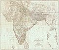
ଫାଇଲ:Map of Hindoostan, 1788, by Rennell.jpg

ଏହି ଦେଖଣାର ଆକାର: ୭୦୨ × ୬୦୦ ପିକ୍ସେଲ । ବାକି ରେଜୋଲୁସନ: ୨୮୧ × ୨୪୦ ପିକ୍ସେଲ | ୫୬୨ × ୪୮୦ ପିକ୍ସେଲ | ୮୯୯ × ୭୬୮ ପିକ୍ସେଲ | ୧,୧୯୯ × ୧,୦୨୪ ପିକ୍ସେଲ | ୨,୩୯୮ × ୨,୦୪୮ ପିକ୍ସେଲ | ୧୪,୬୩୮ × ୧୨,୫୦୧ ପିକ୍ସେଲ.
ମୂଳ ଫାଇଲ (୧୪,୬୩୮ × ୧୨,୫୦୧ ପିକସେଲ, ଫାଇଲ ଆକାର: ୬୭.୮୨ MB, ଏମ.ଆଇ.ଏମ.ଇର ପ୍ରକାର: image/jpeg)
ଫାଇଲ ଇତିହାସ
ଏହା ଫାଇଲଟି ସେତେବେଳେ ଯେମିତି ଦିଶୁଥିଲା ତାହା ଦେଖିବା ପାଇଁ ତାରିଖ/ବେଳା ଉପରେ କ୍ଲିକ କରନ୍ତୁ
| ତାରିଖ/ବେଳ | ନଖ ଦେଖଣା | ଆକାର | ବ୍ୟବହାରକାରୀ | ମତାମତ | |
|---|---|---|---|---|---|
| ଏବେକାର | ୧୮:୫୭, ୨୯ ନଭେମ୍ବର ୨୦୧୬ |  | ୧୪,୬୩୮ × ୧୨,୫୦୧ (୬୭.୮୨ MB) | Zhuyifei1999 | c:User:Rillke/bigChunkedUpload.js: Attempting to make thumb generation work, recompressed with imagemagick: $ convert Map_of_Hindoostan,_1788,_by_Rennell.jpg Map_of_Hindoostan,_1788,_by_Rennell.converted.jpg |
| ୦୫:୧୫, ୧୩ ଅକ୍ଟୋବର ୨୦୧୬ |  | ୧୪,୬୩୮ × ୧୨,୫୦୧ (୬୬ MB) | Yann | c:User:Rillke/bigChunkedUpload.js: removed yellow tint | |
| ୦୪:୩୪, ୧୩ ଅକ୍ଟୋବର ୨୦୧୬ |  | ୧୪,୬୩୮ × ୧୨,୫୦୧ (୧୪.୭୨ MB) | Yann | {{Information |Description={{en|Map of India, 1788.}} |Source=http://pahar.in/indian-subcontinent-pre-1899/ |Date=1788 |Author={{Creator:James Rennell}} |Permission= |other_versions= }} Category:James Rennell Category:Maps of India [[Category:... |
ଫାଇଲ ବ୍ୟବହାର
ଏହି ସବୁପୃଷ୍ଠା ଏହି ଫାଇଲଟିକୁ ଯୋଡ଼ିଥାନ୍ତି:
ଜଗତ ଫାଇଲ ବ୍ୟବହାର
ତଳଲିଖିତ ଉଇକିସବୁ ଏହି ଫାଇଲଟିକୁ ବ୍ୟବହାର କରିଥାନ୍ତି:
- ar.wikipedia.orgରେ ବ୍ୟବହାର
- bn.wikipedia.orgରେ ବ୍ୟବହାର
- cs.wikipedia.orgରେ ବ୍ୟବହାର
- de.wikipedia.orgରେ ବ୍ୟବହାର
- es.wikipedia.orgରେ ବ୍ୟବହାର
- fr.wikipedia.orgରେ ବ୍ୟବହାର
- he.wikipedia.orgରେ ବ୍ୟବହାର
- hi.wikipedia.orgରେ ବ୍ୟବହାର
- uk.wikipedia.orgରେ ବ୍ୟବହାର
- ur.wikipedia.orgରେ ବ୍ୟବହାର


