
ଫାଇଲ:Europe relief laea location map.jpg

ଏହି ଦେଖଣାର ଆକାର: ୭୦୧ × ୫୯୯ ପିକ୍ସେଲ । ବାକି ରେଜୋଲୁସନ: ୨୮୧ × ୨୪୦ ପିକ୍ସେଲ | ୫୬୧ × ୪୮୦ ପିକ୍ସେଲ | ୮୯୮ × ୭୬୮ ପିକ୍ସେଲ | ୧,୧୯୮ × ୧,୦୨୪ ପିକ୍ସେଲ | ୧,୫୮୦ × ୧,୩୫୧ ପିକ୍ସେଲ.
ମୂଳ ଫାଇଲ (୧,୫୮୦ × ୧,୩୫୧ ପିକସେଲ, ଫାଇଲ ଆକାର: ୧.୧ MB, ଏମ.ଆଇ.ଏମ.ଇର ପ୍ରକାର: image/jpeg)
This is a file from the Wikimedia Commons. Information from its description page there is shown below. |
India
ସାରକଥା
| ବିବରଣୀ |
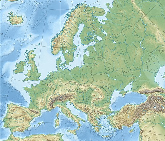
Deutsch: Physische Positionskarte Europa; Flächentreue Azimutalprojektion
English: Physical location map Europe; Lambert azimuthal equal-area projection
|
| ତାରିଖ | |
| ମୂଳାଧାର |
ଆପଣା କାମ
|
| ଲେଖକ | Alexrk2 |
| ଅନ୍ୟ ସଂସ୍କରଣ |
Derivative works of this file:
[]
|


.svg)


_ru.svg)

|
This map has been made or improved in the German Kartenwerkstatt (Map Lab). You can propose maps to improve as well.
|
ସତ୍ଵ
ମୁଁ, ଏହି କାମର ସତ୍ଵାଧିକାରୀ, ଏଠାରେ ତଳଲିଖିତ ଲାଇସେନ୍ସ ଅଧୀନରେ ଏହାକୁ ପ୍ରକାଶ କଲି:
ଏହି ଫାଇଲଟି କ୍ରିଏଟିଭ କମନ୍ସ ଅଧୀନରେ ଆଟ୍ରିବୁସନ ସେଆର-ଏଲାଇକ ୩.୦ ଅନପୋର୍ଟେଡ଼ ଲାଇସେନ୍ସରେ ପଞ୍ଜିକରଣ କରାଯାଇଅଛି ।
- ଆପଣ ଆରାମରେ:
- ବାଣ୍ଟିପାରିବେ – କାମଟିକୁ ନକଲ କରିପାରିବେ, ବାଣ୍ଟିପାରିବେ ଓ ପ୍ରସାରଣ କରିପାରିବେ
- ମିଶାଇପାରିବେ – କାମଟି ଅଭିଯୋଜନ କରିପାରିବେ
- ତଳଲିଖିତ ସର୍ତ୍ତାବଳୀ ଅଧୀନରେ:
- ଶ୍ରେୟ – ଆପଣ ମନେ କରି ଏହି କାମର ଆବଶ୍ୟକୀୟ ଶ୍ରେୟ ମୂଳ ଗଢ଼ାଳି ବା ସ୍ୱତ୍ୱାଧୀକାରୀଙ୍କୁ ଦେବେ ଏବଂ ଦେଲାବେଳେ ଲାଇସେନ୍ସର ଲିଙ୍କ ଦେଇ କି କି ବଦଳ କଲେ ଉଲ୍ଲେଖ କରିବେ । ଏହା ଉପଯୁକ୍ତ ଢଙ୍ଗରେ କରିବେ କିନ୍ତୁ ଲାଇସେନ୍ସ ଦେଉଥିବା ବ୍ୟକ୍ତି ଆପଣଙ୍କ ପ୍ରଚାର କଲା ଭଳି କିଛି ଲେଖିବେ ନାହିଁ ।
- ସେଆର ଏଲାଇକ – ଯଦି ଆପଣ ଏହି କାମଟିକୁ ବଦଳାଇବେ, ରୂପାନ୍ତରଣ କରିବେ ବା ଏହାକୁ ନେଇ କିଛି ଗଢ଼ିବେ ତେବେ ଆପଣ ଏହାକୁ ଏକା ବା ଅଲଗା ଲାଇସେନ୍ସ ଭିତରେ ରଖିପାରିବେ ।
ଫାଇଲ ଇତିହାସ
ଏହା ଫାଇଲଟି ସେତେବେଳେ ଯେମିତି ଦିଶୁଥିଲା ତାହା ଦେଖିବା ପାଇଁ ତାରିଖ/ବେଳା ଉପରେ କ୍ଲିକ କରନ୍ତୁ
| ତାରିଖ/ବେଳ | ନଖ ଦେଖଣା | ଆକାର | ବ୍ୟବହାରକାରୀ | ମତାମତ | |
|---|---|---|---|---|---|
| ଏବେକାର | ୦୩:୫୯, ୫ ଜୁଲାଇ ୨୦୧୮ | | ୧,୫୮୦ × ୧,୩୫୧ (୧.୧ MB) | Subtropical-man | Reverted to version as of 22:56, 20 August 2012 (UTC) |
| ୨୩:୨୪, ୨ ଜୁଲାଇ ୨୦୧୮ |  | ୧,୫୮୦ × ୧,୩୫୧ (୮୨୧ KB) | 1970gemini | fiat lux | |
| ୦୪:୨୬, ୨୧ ଅଗଷ୍ଟ ୨୦୧୨ |  | ୧,୫୮୦ × ୧,୩୫୧ (୧.୧ MB) | McZusatz | Reverted to version as of 10:53, 14 March 2010 (...thumb fixed?) | |
| ୦୪:୨୫, ୨୧ ଅଗଷ୍ଟ ୨୦୧୨ |  | ୧୨୦ × ୧୦୩ (୪ KB) | McZusatz | fixing thumb... | |
| ୧୬:୨୩, ୧୪ ମାର୍ଚ୍ଚ ୨୦୧୦ |  | ୧,୫୮୦ × ୧,୩୫୧ (୧.୧ MB) | Alexrk2 | == Summary == {{Information |Description= {{de|Physische Positionskarte Europa; Flächentreue Azimutalprojektion}} {{en|Physical location map Europe; Lambert azimuthal equal-area projection}} * Projection: LAEA Europe, [http: |
ଫାଇଲ ବ୍ୟବହାର
ଏହି ସବୁପୃଷ୍ଠା ଏହି ଫାଇଲଟିକୁ ଯୋଡ଼ିଥାନ୍ତି:
ଜଗତ ଫାଇଲ ବ୍ୟବହାର
ତଳଲିଖିତ ଉଇକିସବୁ ଏହି ଫାଇଲଟିକୁ ବ୍ୟବହାର କରିଥାନ୍ତି:
- ab.wikipedia.orgରେ ବ୍ୟବହାର
- als.wikipedia.orgରେ ବ୍ୟବହାର
- ar.wikipedia.orgରେ ବ୍ୟବହାର
- arz.wikipedia.orgରେ ବ୍ୟବହାର
- ast.wikipedia.orgରେ ବ୍ୟବହାର
- av.wikipedia.orgରେ ବ୍ୟବହାର
- azb.wikipedia.orgରେ ବ୍ୟବହାର
- az.wikipedia.orgରେ ବ୍ୟବହାର
ଏହି ଫାଇଲଟିର ଅଧିକ ବିଶ୍ୱବ୍ୟାପୀ ବ୍ୟବହାର ଦେଖନ୍ତୁ ।