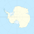
ଫାଇଲ:Antarctica relief location map.jpg
ଦେଖଣା

ଏହି ଦେଖଣାର ଆକାର: ୬୦୦ × ୬୦୦ ପିକ୍ସେଲ । ବାକି ରେଜୋଲୁସନ: ୨୪୦ × ୨୪୦ ପିକ୍ସେଲ | ୪୮୦ × ୪୮୦ ପିକ୍ସେଲ | ୭୬୮ × ୭୬୮ ପିକ୍ସେଲ | ୧,୦୨୪ × ୧,୦୨୪ ପିକ୍ସେଲ | ୧,୪୯୩ × ୧,୪୯୩ ପିକ୍ସେଲ.
ମୂଳ ଫାଇଲ (୧,୪୯୩ × ୧,୪୯୩ ପିକସେଲ, ଫାଇଲ ଆକାର: ୪୫୯ KB, ଏମ.ଆଇ.ଏମ.ଇର ପ୍ରକାର: image/jpeg)
ଫାଇଲ ଇତିହାସ
ଏହା ଫାଇଲଟି ସେତେବେଳେ ଯେମିତି ଦିଶୁଥିଲା ତାହା ଦେଖିବା ପାଇଁ ତାରିଖ/ବେଳା ଉପରେ କ୍ଲିକ କରନ୍ତୁ
| ତାରିଖ/ବେଳ | ନଖ ଦେଖଣା | ଆକାର | ବ୍ୟବହାରକାରୀ | ମତାମତ | |
|---|---|---|---|---|---|
| ଏବେକାର | ୧୩:୨୨, ୨୬ ଜୁଲାଇ ୨୦୧୭ |  | ୧,୪୯୩ × ୧,୪୯୩ (୪୫୯ KB) | Amga | Reverted to version as of 16:03, 3 May 2011 (UTC). This is used in location maps, so don't rotate it! |
| ୦୫:୩୦, ୨୬ ଜୁଲାଇ ୨୦୧୭ |  | ୧,୪୮୮ × ୧,୪୯୩ (୪୫୮ KB) | SteinsplitterBot | Bot: Image rotated by 90° | |
| ୨୧:୩୩, ୩ ମଇ ୨୦୧୧ |  | ୧,୪୯୩ × ୧,୪୯୩ (୪୫୯ KB) | Alexrk2 | light blue hypso colors | |
| ୦୨:୫୪, ୨୨ ଫେବୃଆରୀ ୨୦୧୦ |  | ୧,୫୦୦ × ୧,୫୦୦ (୮୧୮ KB) | Alexrk2 | == Summary == {{Information |Description= {{de|Physische Positionskarte Antarktis, Mittabstandstreue Azimutalprojektion}} {{en|Physical Location map Antarctica, Azimuthal equidistant projection}} * Longitude of central |
ଫାଇଲ ବ୍ୟବହାର
ଏହି ଫାଇଲ ସହିତ ଯୋଡ଼ା ଗୋଟିଏ ବି ପୃଷ୍ଠା ନାହିଁ ।
ଜଗତ ଫାଇଲ ବ୍ୟବହାର
ତଳଲିଖିତ ଉଇକିସବୁ ଏହି ଫାଇଲଟିକୁ ବ୍ୟବହାର କରିଥାନ୍ତି:
- af.wikipedia.orgରେ ବ୍ୟବହାର
- ar.wikipedia.orgରେ ବ୍ୟବହାର
- arz.wikipedia.orgରେ ବ୍ୟବହାର
- ast.wikipedia.orgରେ ବ୍ୟବହାର
- az.wikipedia.orgରେ ବ୍ୟବହାର
- Şablon:Yer xəritəsi Antarktida
- Antarktik yarımadası
- Şablon:Yer xəritəsi Antarktida (fiziki)
- Antarktik boğazı
- Jerlaş boğazı
- Bransfild boğazı
- Lemeir boğazı
- Vostok gölü
- Friksel gölü
- Mak-Medro boğazı
- Veddell dənizi
- Birlik dənizi
- Riser-Larsen dənizi
- Kosmonavtlar dənizi
- Mouson dənizi
- Dürvil dənizi
- Somov dənizi
- Kral VII Haakon dənizi
- Deyvis dənizi
- Lazarev dənizi
- Bellinshauzen dənizi
- Amundsen dənizi
- Ross dənizi
- Skotia dənizi
- Mouson yarımadası
- Hat Point yarımadası
- I Aleksandr Torpağı
- Berkner
- Ross adası
- Erebus vulkanı
- Saypl
- Terston
- Karney
- Ruzvelt adası (Antarktida)
- Sifre burnu
- Cənubi Şetland adaları
- Cənubi Orkney adaları
- Koroneyşen
ଏହି ଫାଇଲଟିର ଅଧିକ ବିଶ୍ୱବ୍ୟାପୀ ବ୍ୟବହାର ଦେଖନ୍ତୁ ।


