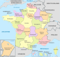
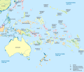
ଫାଇଲ:Antarctica, administrative divisions - de - colored (explicit).svg

ମୂଳ ଫାଇଲ (SVG ଫାଇଲ, ସାଧାରଣ ମାପ ୧,୨୦୦ × ୧,୨୦୦ ପିକ୍ସେଲ, ଫାଇଲ ଆକାର: ୭୮୭ KB)
This is a file from the Wikimedia Commons. Information from its description page there is shown below. |
ସାରକଥା
ସତ୍ଵ
- ଆପଣ ଆରାମରେ:
- ବାଣ୍ଟିପାରିବେ – କାମଟିକୁ ନକଲ କରିପାରିବେ, ବାଣ୍ଟିପାରିବେ ଓ ପ୍ରସାରଣ କରିପାରିବେ
- ମିଶାଇପାରିବେ – କାମଟି ଅଭିଯୋଜନ କରିପାରିବେ
- ତଳଲିଖିତ ସର୍ତ୍ତାବଳୀ ଅଧୀନରେ:
- ଶ୍ରେୟ – ଆପଣ ମନେ କରି ଏହି କାମର ଆବଶ୍ୟକୀୟ ଶ୍ରେୟ ମୂଳ ଗଢ଼ାଳି ବା ସ୍ୱତ୍ୱାଧୀକାରୀଙ୍କୁ ଦେବେ ଏବଂ ଦେଲାବେଳେ ଲାଇସେନ୍ସର ଲିଙ୍କ ଦେଇ କି କି ବଦଳ କଲେ ଉଲ୍ଲେଖ କରିବେ । ଏହା ଉପଯୁକ୍ତ ଢଙ୍ଗରେ କରିବେ କିନ୍ତୁ ଲାଇସେନ୍ସ ଦେଉଥିବା ବ୍ୟକ୍ତି ଆପଣଙ୍କ ପ୍ରଚାର କଲା ଭଳି କିଛି ଲେଖିବେ ନାହିଁ ।
- ସେଆର ଏଲାଇକ – ଯଦି ଆପଣ ଏହି କାମଟିକୁ ବଦଳାଇବେ, ରୂପାନ୍ତରଣ କରିବେ ବା ଏହାକୁ ନେଇ କିଛି ଗଢ଼ିବେ ତେବେ ଆପଣ ଏହାକୁ ଏକା ବା ଅଲଗା ଲାଇସେନ୍ସ ଭିତରେ ରଖିପାରିବେ ।

|
I'd greatly appreciate, that you attribute this media file to Wikimedia Commons, if used outside Wikipedia or Commons. For use in publications such as books, newspapers, blogs, websites, please insert here the following line:
বাংলা ∙ Deutsch ∙ Deutsch (Sie-Form) ∙ Ελληνικά ∙ English ∙ español ∙ français ∙ Ἀρχαία ἑλληνικὴ ∙ Bahasa Indonesia ∙ 日本語 ∙ македонски ∙ Nederlands ∙ português ∙ русский ∙ Türkçe ∙ 简体中文 ∙ 繁體中文 ∙ +/− |
Captions
Items portrayed in this file
ଦର୍ଶାଏ
creator ଇଂରାଜୀ
some value
copyright status ଇଂରାଜୀ
copyrighted ଇଂରାଜୀ
୧୭ ଅକ୍ଟୋବର 2012
source of file ଇଂରାଜୀ
media type ଇଂରାଜୀ
image/svg+xml
checksum ଇଂରାଜୀ
a369b23fe57731889a6d8a2df6abf6aae36c2de0
data size ଇଂରାଜୀ
୮,୦୫,୪୭୦ byte
୧,୨୦୦ pixel
୧,୨୦୦ pixel
ଫାଇଲ ଇତିହାସ
ଏହା ଫାଇଲଟି ସେତେବେଳେ ଯେମିତି ଦିଶୁଥିଲା ତାହା ଦେଖିବା ପାଇଁ ତାରିଖ/ବେଳା ଉପରେ କ୍ଲିକ କରନ୍ତୁ
| ତାରିଖ/ବେଳ | ନଖ ଦେଖଣା | ଆକାର | ବ୍ୟବହାରକାରୀ | ମତାମତ | |
|---|---|---|---|---|---|
| ଏବେକାର | ୧୬:୦୦, ୨୫ ଅକ୍ଟୋବର ୨୦୧୨ |  | ୧,୨୦୦ × ୧,୨୦୦ (୭୮୭ KB) | TUBS | |
| ୧୫:୫୭, ୨୫ ଅକ୍ଟୋବର ୨୦୧୨ |  | ୧,୨୦୦ × ୧,୨୦୦ (୭୭୮ KB) | TUBS | == {{int:filedesc}} == {{Information |Description={{de|Karte der politischen Gliederung von XY (siehe Dateiname)}} {{en|Map of administrative divisions of XY (see filename)}} |Source={{own}}{{Adobe Illustrator}}{{Commonist}}{{AttribSVG|Queen_Maud_Land... |
ଫାଇଲ ବ୍ୟବହାର
ଏହି ଫାଇଲ ସହିତ ଯୋଡ଼ା ଗୋଟିଏ ବି ପୃଷ୍ଠା ନାହିଁ ।
ଜଗତ ଫାଇଲ ବ୍ୟବହାର
ତଳଲିଖିତ ଉଇକିସବୁ ଏହି ଫାଇଲଟିକୁ ବ୍ୟବହାର କରିଥାନ୍ତି:
- de.wikipedia.orgରେ ବ୍ୟବହାର
- he.wikipedia.orgରେ ବ୍ୟବହାର
- hu.wiktionary.orgରେ ବ୍ୟବହାର
ମେଟାଡାଟା
ଏହି ଫାଇଲରେ ଅତିରିକ୍ତ ସୂଚନା ରହିଛି ଓ ତାହା ବୋଧେ ଏହାକୁ ତିଆରି ବା ଡିଜିଟାଇଜ କରିଥିବା ଡିଜିଟାଲ କ୍ଯାମେରା କିମ୍ବା ସ୍କାନରରୁ ଆସିଥିଲା । ଫାଇଲଟି ଏହାର ମୂଳ ଅବସ୍ଥାରୁ ବଦଳାଯାଇଥିଲେ କିଛି ସୂଚନା ପରିବର୍ତ୍ତିତ ଫାଇଲର ସମ୍ପୂର୍ଣ୍ଣ ପ୍ରତିଫଳିତ ହୋଇନପାରେ ।
| ଓସାର | 1200px |
|---|---|
| ଉଚ୍ଚତା | 1200px |


