
ଫାଇଲ:Map of USA with county outlines.png

ଏହି ଦେଖଣାର ଆକାର: ୮୦୦ × ୫୨୦ ପିକ୍ସେଲ । ବାକି ରେଜୋଲୁସନ: ୩୨୦ × ୨୦୮ ପିକ୍ସେଲ | ୬୪୦ × ୪୧୬ ପିକ୍ସେଲ | ୧,୦୨୪ × ୬୬୫ ପିକ୍ସେଲ | ୧,୫୧୩ × ୯୮୩ ପିକ୍ସେଲ.
ମୂଳ ଫାଇଲ (୧,୫୧୩ × ୯୮୩ ପିକସେଲ, ଫାଇଲ ଆକାର: ୫୮୧ KB, ଏମ.ଆଇ.ଏମ.ଇର ପ୍ରକାର: image/png)
This is a file from the Wikimedia Commons. Information from its description page there is shown below. |

|
This locator map image could be re-created using vector graphics as an SVG file. This has several advantages; see Commons:Media for cleanup for more information. If an SVG form of this image is available, please upload it and afterwards replace this template with
{{vector version available|new image name}}.
It is recommended to name the SVG file “Map of USA with county outlines.svg”—then the template Vector version available (or Vva) does not need the new image name parameter. |
ସାରକଥା
| ବିବରଣୀ |
Deutsch: Karte der Vereinigten Staaten mit den Staats- und Kreisgrenzen.
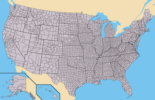
English: Map of the USA showing borders of states and counties. Colored version of adapted one by Wapcaplet from a public-domain map courtesy of the U.S. Census Bureau website first published in English language version of Wikipedia.
Español: Mapa de los es:Estados Unidos mostrando los los límites de estados miembros y sus condados. Versión a colores de la adaptación hecha por Wapcaplet del mapa de dominio público del sitio web de la Oficina de Censo de los EE.UU.. |
| ତାରିଖ | |
| ମୂଳାଧାର | https://www.census.gov |
| ଲେଖକ | |
| ଅନ୍ୟ ସଂସ୍କରଣ | Derivative works of this file: Emancipation Proclamation.PNG |
ସତ୍ଵ

|
ମାଗଣା ସଫ୍ଟବେର ଫାଉଣ୍ଡେସନ ଦେଇ ପ୍ରକାଶିତ କୌଣସି ବଦଳାଇ ନହେବା ଭଳି ଧାରା, ଆଗ ବା ପଛ ପଟ ମଲାଟ ବିନା GNU ଖୋଲା ଦଲିଲକାରଣ ଲାଇସେନ୍ସ ୧.୨ ତମ ସଙ୍କଳନ ବା ଆଉ କୌଣସି ସର୍ତ୍ତାବଳି ଅନୁସାରେ ଏହି ଦଲିଲର ନକଲ, ବଣ୍ଟନ ତଥା/କିମ୍ବା ବଦଳାଇବା ନିମନ୍ତେ ଅନୁମତି ଦିଆଗଲା । GNU ମାଗଣା ଦଲିଲକରଣ ଲାଇସେନ୍ସ ନାମକ ବିଭାଗରେ ଲାଇସେନ୍ସର ନକଲ ଦିଆଯାଇଅଛି । |
| ଏହି ଫାଇଲଟି କ୍ରିଏଟିଭ କମନ୍ସ ଅଧୀନରେ ଆଟ୍ରିବୁସନ ସେଆର-ଏଲାଇକ ୩.୦ ଅନପୋର୍ଟେଡ଼ ଲାଇସେନ୍ସରେ ପଞ୍ଜିକରଣ କରାଯାଇଅଛି । | ||
| ||
| GFDL ଲାଇସେନ୍ସ ଅପଡେଟର ଏକ ଭାଗ ଭାବରେ ଏହି ଲାଇସେନ୍ସ ଚିହ୍ନଟି ଏହି ଫାଇଲରେ ଯୋଡ଼ା ଯାଇଥିଲା । |
ଫାଇଲ ଇତିହାସ
ଏହା ଫାଇଲଟି ସେତେବେଳେ ଯେମିତି ଦିଶୁଥିଲା ତାହା ଦେଖିବା ପାଇଁ ତାରିଖ/ବେଳା ଉପରେ କ୍ଲିକ କରନ୍ତୁ
| ତାରିଖ/ବେଳ | ନଖ ଦେଖଣା | ଆକାର | ବ୍ୟବହାରକାରୀ | ମତାମତ | |
|---|---|---|---|---|---|
| ଏବେକାର | ୨୧:୫୫, ୩୧ ମଇ ୨୦୧୫ | | ୧,୫୧୩ × ୯୮୩ (୫୮୧ KB) | Cmdrjameson | Compressed with pngout. Reduced by 484kB (45% decrease). |
| ୧୯:୩୨, ୨୧ ସେପ୍ଟେମ୍ବର ୨୦୧୦ |  | ୧,୫୧୩ × ୯୮୩ (୧.୦୪ MB) | Kmusser | fix Pamlico Sound | |
| ୦୫:୦୧, ୨୬ ନଭେମ୍ବର ୨୦୦୯ |  | ୧,୫୧୩ × ୯୮୩ (୧୬୬ KB) | Reywas92 | Make borders more visible. | |
| ୧୦:୧୧, ୨୩ ଜାନୁଆରୀ ୨୦୦୮ |  | ୧,୫୧୩ × ୯୮୩ (୯୮ KB) | Speight | Fix San Francisco Bay and Puget Sound | |
| ୦୪:୨୩, ୨୪ ନଭେମ୍ବର ୨୦୦୬ |  | ୧,୫୧୩ × ୯୮୩ (୧୬୫ KB) | Ibagli | more fixes | |
| ୦୪:୨୩, ୨୪ ନଭେମ୍ବର ୨୦୦୬ |  | ୧,୫୧୩ × ୯୮୩ (୧୬୫ KB) | Ibagli | Reverted to earlier revision | |
| ୦୪:୨୨, ୨୪ ନଭେମ୍ବର ୨୦୦୬ |  | ୧,୫୧୩ × ୯୮୩ (୧୮୦ KB) | Ibagli | more fixes | |
| ୦୭:୪୬, ୨୩ ନଭେମ୍ବର ୨୦୦୬ |  | ୧,୫୧୩ × ୯୮୩ (୧୬୫ KB) | Ibagli | fix lake St. Clair | |
| ୦୨:୨୭, ୨୯ ଅଗଷ୍ଟ ୨୦୦୫ |  | ୧,୫୧୩ × ୯୮୩ (୧୬୫ KB) | Huhsunqu | *{{es}} Mapa de los Estados Unidos de América mostrando los los límites de estados miembros y sus condados. Versión a colores de la adaptación hecha por Wapcaplet del mapa de dominio público del [http://www.census.gov/ sitio |
ଫାଇଲ ବ୍ୟବହାର
ଏହି ଫାଇଲ ସହିତ ଯୋଡ଼ା ଗୋଟିଏ ବି ପୃଷ୍ଠା ନାହିଁ ।
ଜଗତ ଫାଇଲ ବ୍ୟବହାର
ତଳଲିଖିତ ଉଇକିସବୁ ଏହି ଫାଇଲଟିକୁ ବ୍ୟବହାର କରିଥାନ୍ତି:
- ang.wikipedia.orgରେ ବ୍ୟବହାର
- az.wikipedia.orgରେ ବ୍ୟବହାର
- bg.wikipedia.orgରେ ବ୍ୟବହାର
- ca.wikipedia.orgରେ ବ୍ୟବହାର
- cs.wikipedia.orgରେ ବ୍ୟବହାର
- de.wikipedia.orgରେ ବ୍ୟବହାର
- en.wikipedia.orgରେ ବ୍ୟବହାର
- Talk:Bigfoot/Archive 5
- Talk:Manhattan
- Talk:Los Angeles County, California
- Talk:List of counties in Nevada
- Talk:Louisville, Kentucky
- Wikipedia:WikiProject U.S. counties
- Wikipedia talk:WikiProject U.S. counties
- Talk:Lancaster County, Pennsylvania
- Talk:Frederick County, Maryland
- Talk:Franklin County, Tennessee
- Talk:Trumbull County, Ohio
- Talk:Tuscarawas County, Ohio
- Talk:Union County, Ohio
- Talk:Van Wert County, Ohio
- Talk:Vinton County, Ohio
- Talk:Warren County, Ohio
- Talk:Washington County, Ohio
- Talk:Wayne County, Ohio
- Talk:Williams County, Ohio
- Talk:Wood County, Ohio
- Talk:Wyandot County, Ohio
- Talk:Adair County, Oklahoma
- Talk:Alfalfa County, Oklahoma
- Talk:Atoka County, Oklahoma
- Talk:Blaine County, Oklahoma
- Talk:Bryan County, Oklahoma
- Talk:Caddo County, Oklahoma
- Talk:Carter County, Oklahoma
- Talk:Cherokee County, Oklahoma
- Talk:Nantucket
- Talk:Potter County, South Dakota
- Talk:Weston County, Wyoming
- Talk:Washakie County, Wyoming
- Talk:Uinta County, Wyoming
- Talk:Teton County, Wyoming
- Talk:Sweetwater County, Wyoming
- Talk:Sublette County, Wyoming
- Talk:Sheridan County, Wyoming
ଏହି ଫାଇଲଟିର ଅଧିକ ବିଶ୍ୱବ୍ୟାପୀ ବ୍ୟବହାର ଦେଖନ୍ତୁ ।