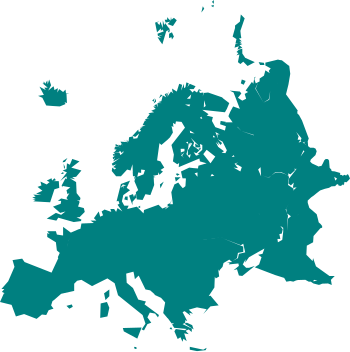
ଫାଇଲ:Cartography of Europe.svg

Size of this PNG preview of this SVG file: ୩୫୦ × ୩୫୧ ପିକ୍ସେଲ. ବାକି ରେଜୋଲୁସନ: ୨୩୯ × ୨୪୦ ପିକ୍ସେଲ | ୪୭୯ × ୪୮୦ ପିକ୍ସେଲ | ୭୬୬ × ୭୬୮ ପିକ୍ସେଲ | ୧,୦୨୧ × ୧,୦୨୪ ପିକ୍ସେଲ | ୨,୦୪୨ × ୨,୦୪୮ ପିକ୍ସେଲ.
ମୂଳ ଫାଇଲ (SVG ଫାଇଲ, ସାଧାରଣ ମାପ ୩୫୦ × ୩୫୧ ପିକ୍ସେଲ, ଫାଇଲ ଆକାର: ୩୧ KB)
ଫାଇଲ ଇତିହାସ
ଏହା ଫାଇଲଟି ସେତେବେଳେ ଯେମିତି ଦିଶୁଥିଲା ତାହା ଦେଖିବା ପାଇଁ ତାରିଖ/ବେଳା ଉପରେ କ୍ଲିକ କରନ୍ତୁ
| ତାରିଖ/ବେଳ | ନଖ ଦେଖଣା | ଆକାର | ବ୍ୟବହାରକାରୀ | ମତାମତ | |
|---|---|---|---|---|---|
| ଏବେକାର | ୧୯:୨୯, ୨୪ ମାର୍ଚ୍ଚ ୨୦୨୧ |  | ୩୫୦ × ୩୫୧ (୩୧ KB) | PastelKos | Reverted to version as of 23:02, 23 May 2020 (UTC) so as to match with the other "cartography of ___" maps |
| ୧୮:୨୩, ୨୧ ଜାନୁଆରୀ ୨୦୨୧ |  | ୩୫୦ × ୩୫୧ (୩୧ KB) | Est. 2021 | Reverted to version as of 15:33, 6 January 2010 (UTC) | |
| ୦୪:୩୨, ୨୪ ମଇ ୨୦୨୦ |  | ୩୫୦ × ୩୫୧ (୩୧ KB) | Sittaco | Reverted to version as of 00:20, 12 September 2009 (UTC) | |
| ୨୧:୦୩, ୬ ଜାନୁଆରୀ ୨୦୧୦ |  | ୩୫୦ × ୩୫୧ (୩୧ KB) | Hayden120 | Changed colour to blue; a colour commonly associated with Europe. It also matches the style of 'Portal:Europe' on the English Wikipedia. | |
| ୦୫:୫୦, ୧୨ ସେପ୍ଟେମ୍ବର ୨୦୦୯ |  | ୩୫୦ × ୩୫୧ (୩୧ KB) | TownDown | {{Information |Description={{en|1=x}} |Source=Own work by uploader |Author=TownDown |Date= |Permission= |other_versions= }} Category:svg |
ଫାଇଲ ବ୍ୟବହାର
ଏହି ଫାଇଲ ସହିତ ଯୋଡ଼ା ଗୋଟିଏ ବି ପୃଷ୍ଠା ନାହିଁ ।
ଜଗତ ଫାଇଲ ବ୍ୟବହାର
ତଳଲିଖିତ ଉଇକିସବୁ ଏହି ଫାଇଲଟିକୁ ବ୍ୟବହାର କରିଥାନ୍ତି:
- ar.wikipedia.orgରେ ବ୍ୟବହାର
- بوابة:ألمانيا
- بوابة:ألمانيا/بوابات شقيقة
- بوابة:إيطاليا
- بوابة:إيطاليا/بوابات شقيقة
- بوابة:فرنسا
- بوابة:إسبانيا
- بوابة:النمسا
- بوابة:البرتغال
- بوابة:سويسرا
- بوابة:كرواتيا
- بوابة:كرواتيا/شقيقة
- بوابة:بلغاريا
- بوابة:بلغاريا/شقيقة
- بوابة:المجر
- بوابة:المجر/شقيقة
- ويكيبيديا:مشروع ويكي الاتحاد الأوروبي
- بوابة:النمسا/شقيقة
- بوابة:اليونان
- بوابة:اليونان/شقيقة
- بوابة:الدنمارك/بوابات شقيقة
- بوابة:الدنمارك
- بوابة:رومانيا/بوابات شقيقة
- بوابة:رومانيا
- بوابة:ألبانيا/بوابات شقيقة
- بوابة:ألبانيا
- بوابة:مقدونيا الشمالية/بوابات شقيقة
- بوابة:مقدونيا الشمالية
- بوابة:صربيا/بوابات شقيقة
- بوابة:صربيا
- بوابة:البلقان/بوابات شقيقة
- بوابة:البلقان
- بوابة:كوسوفو/بوابات شقيقة
- بوابة:الجبل الأسود/بوابات شقيقة
- بوابة:الجبل الأسود
- بوابة:كوسوفو
- بوابة:البرتغال/بوابات شقيقة
- بوابة:المتوسط
- بوابة:المتوسط/بوابات شقيقة
- بوابة:ألبانيا/شقيقة
- بوابة:إسبانيا/بوابات شقيقة
- بوابة:سويسرا/بوابات أخرى
- بوابة:فرنسا/بوابات شقيقة
- بوابة:دورتموند
- بوابة:دورتموند/بوابات شقيقة
- bn.wikipedia.orgରେ ବ୍ୟବହାର
- cs.wikipedia.orgରେ ବ୍ୟବହାର
- de.wikipedia.orgରେ ବ୍ୟବହାର
- el.wikipedia.orgରେ ବ୍ୟବହାର
ଏହି ଫାଇଲଟିର ଅଧିକ ବିଶ୍ୱବ୍ୟାପୀ ବ୍ୟବହାର ଦେଖନ୍ତୁ ।


