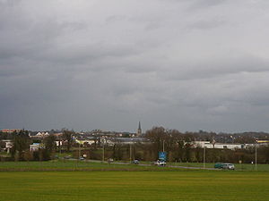
Chantepie
ଦେଖଣା
commune in Ille-et-Vilaine, France
ଦୃଷ୍ଟାନ୍ତ
commune of France
ସରକାରୀ ନାମ
Chantepie[୫]
ଦେଶ
ଫ୍ରାନ୍ସ[୬]
ପ୍ରଶାସନିକ ବିଭାଗ ଅନ୍ତର୍ଗତ
arrondissement of Rennes
Ille-et-Vilaine
Rennes Métropole
located in time zone
UTC+01:00
valid in period: standard time
UTC+02:00
valid in period: daylight saving time
located in statistical territorial entity
Q108921718
Q3551120
ଭୂଜକୋଟି
office held by head of government
Mayor of Chantepie
ଲୋକସଂଖ୍ୟା
male population
female population
ସମୁଦ୍ର ପତ୍ତନଠାରୁ ଉଚ୍ଚତା
୫୮ ମିଟର
ଦ୍ଵୈତ ସହର
Verrayes
Obrigheim
ଆରମ୍ଭ ସମୟ: ମଇ 1998
Krško
ପଡ଼ୋଶୀ
Rennes
Domloup
Noyal-Châtillon-sur-Seiche
Vern-sur-Seiche
Cesson-Sévigné
area
୧୧.୯୮ ବର୍ଗ କିଲୋମିଟର[୯]
ପୋଷ୍ଟାଲ କୋଡ଼
35135[୧୩]
phone number
+33-2-99-41-42-33[୧୪]
fax number
+33-2-99-41-48-69[୧୪]
email address
ଆଧିକାରିକ ୱେବସାଇଟ
କମନ୍ସ ଶ୍ରେଣୀ
Chantepie
ବିଷୟର ମୁଖ୍ୟ ଶ୍ରେଣୀ
Category:Chantepie
category for maps or plans
Category:Maps of Chantepie
ଆଧାର
- ↑ Freebase Data Dumps, ୨୮ ଅକ୍ଟୋବର 2013
- ↑ GeoNames
- ↑ ସୂଚନା, ୨୬ ଅଗଷ୍ଟ 2015
- ↑ ୧୦ ମଇ 2018
- ↑ Code officiel géographique, https://www.insee.fr/fr/information/3363419, ୬ ଜାନୁଆରୀ 2019
- ↑ Geographic Names Server, ୧୧ ଜୁନ 2018, -1418504
- ↑ Code officiel géographique, ୨୬ ଫେବୃଆରୀ 2020, https://www.data.gouv.fr/fr/datasets/r/8442dfae-a878-49c6-be4c-20689b1c337c
- ↑ Code officiel géographique, ୨୨ ସେପ୍ଟେମ୍ବର 2017, https://www.insee.fr/fr/information/2560698
- ↑ ୯.୦ ୯.୧ répertoire géographique des communes, ୨୬ ଅକ୍ଟୋବର 2015
- ↑ Populations légales 2021
- ↑ ୧୧.୦ ୧୧.୧ The National Institute of Statistics and Economic Studies
- ↑ ୧୨.୦ ୧୨.୧ répertoire géographique des communes, https://wxs-telechargement.ign.fr/83edtfdyqte031y0ra49d2e3/telechargement/inspire/RGC-2015-01$RGC2015/file/RGC2015.7z, RGC_2015.txt, 2015, http://web.archive.org/web/20160804005551if_/https://wxs-telechargement.ign.fr/83edtfdyqte031y0ra49d2e3/telechargement/inspire/RGC-2015-01$RGC2015/file/RGC2015.7z
- ↑ dataset of postal codes in France, ୧ ଅକ୍ଟୋବର 2018
- ↑ ୧୪.୦ ୧୪.୧ ୧୪.୨ ୧୪.୩ Annuaire de service-public.fr, ୨୩ ସେପ୍ଟେମ୍ବର 2023


