
ଫାଇଲ:Map - NL - Municipality code 0852 (2009).svg

Size of this PNG preview of this SVG file: ୩୦୦ × ୧୬୦ ପିକ୍ସେଲ. ବାକି ରେଜୋଲୁସନ: ୩୨୦ × ୧୭୧ ପିକ୍ସେଲ | ୬୪୦ × ୩୪୧ ପିକ୍ସେଲ | ୧,୦୨୪ × ୫୪୬ ପିକ୍ସେଲ | ୧,୨୮୦ × ୬୮୩ ପିକ୍ସେଲ | ୨,୫୬୦ × ୧,୩୬୫ ପିକ୍ସେଲ.
ମୂଳ ଫାଇଲ (SVG ଫାଇଲ, ସାଧାରଣ ମାପ ୩୦୦ × ୧୬୦ ପିକ୍ସେଲ, ଫାଇଲ ଆକାର: ୫୩୦ KB)
This is a file from the Wikimedia Commons. Information from its description page there is shown below. |
| ବିବରଣୀ |
|
|||
| ତାରିଖ | ||||
| ମୂଳାଧାର | own work , using CBS data | |||
| ଲେଖକ | Michiel1972 (talk) 23:37, 24 January 2009 (UTC) | |||
| ଅନୁମତି (ଏହି ଫାଇଲକୁ ପୁଣି ବ୍ୟବହାର କରିବେ) |
Attribution ShareAlike 3.0 |

.svg)
ଏହି ଫାଇଲଟି କ୍ରିଏଟିଭ କମନ୍ସ ଅଧୀନରେ ଆଟ୍ରିବୁସନ ସେଆର-ଏଲାଇକ ୩.୦ ଅନପୋର୍ଟେଡ଼ ଲାଇସେନ୍ସରେ ପଞ୍ଜିକରଣ କରାଯାଇଅଛି ।
- ଆପଣ ଆରାମରେ:
- ବାଣ୍ଟିପାରିବେ – କାମଟିକୁ ନକଲ କରିପାରିବେ, ବାଣ୍ଟିପାରିବେ ଓ ପ୍ରସାରଣ କରିପାରିବେ
- ମିଶାଇପାରିବେ – କାମଟି ଅଭିଯୋଜନ କରିପାରିବେ
- ତଳଲିଖିତ ସର୍ତ୍ତାବଳୀ ଅଧୀନରେ:
- ଶ୍ରେୟ – ଆପଣ ମନେ କରି ଏହି କାମର ଆବଶ୍ୟକୀୟ ଶ୍ରେୟ ମୂଳ ଗଢ଼ାଳି ବା ସ୍ୱତ୍ୱାଧୀକାରୀଙ୍କୁ ଦେବେ ଏବଂ ଦେଲାବେଳେ ଲାଇସେନ୍ସର ଲିଙ୍କ ଦେଇ କି କି ବଦଳ କଲେ ଉଲ୍ଲେଖ କରିବେ । ଏହା ଉପଯୁକ୍ତ ଢଙ୍ଗରେ କରିବେ କିନ୍ତୁ ଲାଇସେନ୍ସ ଦେଉଥିବା ବ୍ୟକ୍ତି ଆପଣଙ୍କ ପ୍ରଚାର କଲା ଭଳି କିଛି ଲେଖିବେ ନାହିଁ ।
- ସେଆର ଏଲାଇକ – ଯଦି ଆପଣ ଏହି କାମଟିକୁ ବଦଳାଇବେ, ରୂପାନ୍ତରଣ କରିବେ ବା ଏହାକୁ ନେଇ କିଛି ଗଢ଼ିବେ ତେବେ ଆପଣ ଏହାକୁ ଏକା ବା ଅଲଗା ଲାଇସେନ୍ସ ଭିତରେ ରଖିପାରିବେ ।
ଫାଇଲ ଇତିହାସ
ଏହା ଫାଇଲଟି ସେତେବେଳେ ଯେମିତି ଦିଶୁଥିଲା ତାହା ଦେଖିବା ପାଇଁ ତାରିଖ/ବେଳା ଉପରେ କ୍ଲିକ କରନ୍ତୁ
| ତାରିଖ/ବେଳ | ନଖ ଦେଖଣା | ଆକାର | ବ୍ୟବହାରକାରୀ | ମତାମତ | |
|---|---|---|---|---|---|
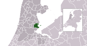
| ଏବେକାର | ୦୫:୦୭, ୨୫ ଜାନୁଆରୀ ୨୦୦୯ | | ୩୦୦ × ୧୬୦ (୫୩୦ KB) | Michiel1972 | {{Information |Description=*Location maps for the 441 municipalities in the Netherlands. Boundaries 1/1/2009 *Automatically generated with script *File name contains "Municipality code" (CBS-code) as specified in: [http://www.cbs.nl/nl-NL/menu/methoden/c |
ଫାଇଲ ବ୍ୟବହାର
ଏହି ଫାଇଲ ସହିତ ଯୋଡ଼ା ଗୋଟିଏ ବି ପୃଷ୍ଠା ନାହିଁ ।
ଜଗତ ଫାଇଲ ବ୍ୟବହାର
ତଳଲିଖିତ ଉଇକିସବୁ ଏହି ଫାଇଲଟିକୁ ବ୍ୟବହାର କରିଥାନ୍ତି:
- ar.wikipedia.orgରେ ବ୍ୟବହାର
- ca.wikipedia.orgରେ ବ୍ୟବହାର
- en.wikipedia.orgରେ ବ୍ୟବହାର
- es.wikipedia.orgରେ ବ୍ୟବହାର
- eu.wikipedia.orgରେ ବ୍ୟବହାର
- fa.wikipedia.orgରେ ବ୍ୟବହାର
- fr.wikipedia.orgରେ ବ୍ୟବହାର
- ga.wikipedia.orgରେ ବ୍ୟବହାର
- hu.wikipedia.orgରେ ବ୍ୟବହାର
- hy.wikipedia.orgରେ ବ୍ୟବହାର
- it.wikipedia.orgରେ ବ୍ୟବହାର
- la.wikipedia.orgରେ ବ୍ୟବହାର
- nl.wikipedia.orgରେ ବ୍ୟବହାର
- pt.wikipedia.orgରେ ବ୍ୟବହାର
- ru.wikipedia.orgରେ ବ୍ୟବହାର
- stq.wikipedia.orgରେ ବ୍ୟବହାର
- tr.wikipedia.orgରେ ବ୍ୟବହାର
- uk.wikipedia.orgରେ ବ୍ୟବହାର
- www.wikidata.orgରେ ବ୍ୟବହାର
- zh-min-nan.wikipedia.orgରେ ବ୍ୟବହାର
- zh.wikipedia.orgରେ ବ୍ୟବହାର
.svg)