
ଫାଇଲ:LocationAtlanticOcean.png

ଏହି ଦେଖଣାର ଆକାର: ୮୦୦ × ୪୦୫ ପିକ୍ସେଲ । ବାକି ରେଜୋଲୁସନ: ୩୨୦ × ୧୬୨ ପିକ୍ସେଲ | ୬୪୦ × ୩୨୪ ପିକ୍ସେଲ | ୧,୦୨୪ × ୫୧୯ ପିକ୍ସେଲ | ୧,୨୮୦ × ୬୪୮ ପିକ୍ସେଲ | ୨,୭୬୦ × ୧,୩୯୮ ପିକ୍ସେଲ.
ମୂଳ ଫାଇଲ (୨,୭୬୦ × ୧,୩୯୮ ପିକସେଲ, ଫାଇଲ ଆକାର: ୨୮୧ KB, ଏମ.ଆଇ.ଏମ.ଇର ପ୍ରକାର: image/png)
This is a file from the Wikimedia Commons. Information from its description page there is shown below. |
ସାରକଥା
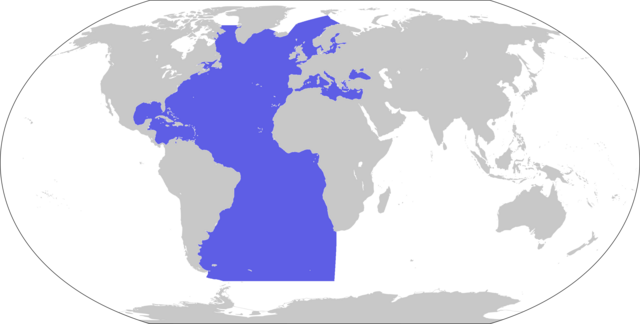
| ବିବରଣୀ | World map depicting Atlantic Ocean; map adapted from PDF World map at CIA World Fact Book |
| ତାରିଖ | |
| ମୂଳାଧାର | 800px-LocationBlank.png |
| ଲେଖକ | user:Xfigpower |
ସତ୍ଵ
This image is in the public domain because it contains materials that originally came from the United States Central Intelligence Agency's World Factbook.
|
 |
ଫାଇଲ ଇତିହାସ
ଏହା ଫାଇଲଟି ସେତେବେଳେ ଯେମିତି ଦିଶୁଥିଲା ତାହା ଦେଖିବା ପାଇଁ ତାରିଖ/ବେଳା ଉପରେ କ୍ଲିକ କରନ୍ତୁ
| ତାରିଖ/ବେଳ | ନଖ ଦେଖଣା | ଆକାର | ବ୍ୟବହାରକାରୀ | ମତାମତ | |
|---|---|---|---|---|---|
| ଏବେକାର | ୦୦:୧୭, ୩୦ ଜାନୁଆରୀ ୨୦୨୪ | | ୨,୭୬୦ × ୧,୩୯୮ (୨୮୧ KB) | Janitoalevic | . |
| ୧୩:୪୦, ୨୮ ମାର୍ଚ୍ଚ ୨୦୧୯ |  | ୨,୭୬୦ × ୧,୩୯୮ (୨୨୩ KB) | Lasunncty | Higher resolution and more accurate boundaries | |
| ୦୪:୦୪, ୪ ଜୁନ ୨୦୧୮ |  | ୮୦୦ × ୪୦୭ (୫୨ KB) | Janitoalevic | . | |
| ୧୯:୨୬, ୩୦ ନଭେମ୍ବର ୨୦୦୬ |  | ୮୦୦ × ୪୦୭ (୭୩ KB) | Xfigpower | {{Information |Description=World map depicting Atlantic Ocean; map adapted from PDF World map at CIA World Fact Book |Source=800px-LocationBlank.png |Date=2006-11-30 |Author=user:Xfigpower |Permis |
ଫାଇଲ ବ୍ୟବହାର
ଏହି ଫାଇଲ ସହିତ ଯୋଡ଼ା ଗୋଟିଏ ବି ପୃଷ୍ଠା ନାହିଁ ।
ଜଗତ ଫାଇଲ ବ୍ୟବହାର
ତଳଲିଖିତ ଉଇକିସବୁ ଏହି ଫାଇଲଟିକୁ ବ୍ୟବହାର କରିଥାନ୍ତି:
- an.wikipedia.orgରେ ବ୍ୟବହାର
- ar.wikipedia.orgରେ ବ୍ୟବହାର
- المغرب العربي
- رأس الرجاء الصالح
- آيسلندا
- إسبانيا
- المحيط الهندي
- برمودا
- المحيط الهادئ
- ساو تومي وبرينسيب
- تاريخ ليبيا القديم
- قنطبرية
- قناة بنما
- الدار البيضاء
- أشتورية
- منطقة إقليم الباسك
- جليقية (منطقة)
- تصنيف:آيسلندا
- جزر الكناري
- جرينلاند
- مونتسرات
- مارتينيك
- المحيط المتجمد الشمالي
- المحيط المتجمد الجنوبي
- خليج المكسيك
- البحر الكاريبي
- ميناء الدار البيضاء
- غوادلوب
- جزر العذراء البريطانية
- جزيرة مان
- تيتانيك (فيلم 1997)
- البحر الأيرلندي
- تصنيف:تاريخ ليبيا القديم
- قناة برستل
- جزر فوكلاند
- جزيرة أيرلندا
- سان سيباستيان
- سان بيير وميكلون
- شنت أندر
- محيط (جغرافيا)
- خليج غينيا
- تصنيف:الجزر العذراء الأمريكية
- من الأرض إلى القمر
- جزر البهاما
- سكاغيراك
- المغرب الكبير (مصطلح)
- الأزور
- سان بارتيلمي
- تجمع سان مارتين
- ميناء سانتوس
- جسر ويليامزبرغ
ଏହି ଫାଇଲଟିର ଅଧିକ ବିଶ୍ୱବ୍ୟାପୀ ବ୍ୟବହାର ଦେଖନ୍ତୁ ।