
ଫାଇଲ:Ile-de-France region relief location map.jpg

ଏହି ଦେଖଣାର ଆକାର: ୭୪୨ × ୬୦୦ ପିକ୍ସେଲ । ବାକି ରେଜୋଲୁସନ: ୨୯୭ × ୨୪୦ ପିକ୍ସେଲ | ୫୯୪ × ୪୮୦ ପିକ୍ସେଲ | ୯୫୧ × ୭୬୮ ପିକ୍ସେଲ | ୧,୨୬୭ × ୧,୦୨୪ ପିକ୍ସେଲ | ୧,୬୫୧ × ୧,୩୩୪ ପିକ୍ସେଲ.
ମୂଳ ଫାଇଲ (୧,୬୫୧ × ୧,୩୩୪ ପିକସେଲ, ଫାଇଲ ଆକାର: ୫୫୨ KB, ଏମ.ଆଇ.ଏମ.ଇର ପ୍ରକାର: image/jpeg)
This is a file from the Wikimedia Commons. Information from its description page there is shown below. |
ସାରକଥା
| Camera location | | View this and other nearby images on: OpenStreetMap |
|---|
| ବିବରଣୀ |
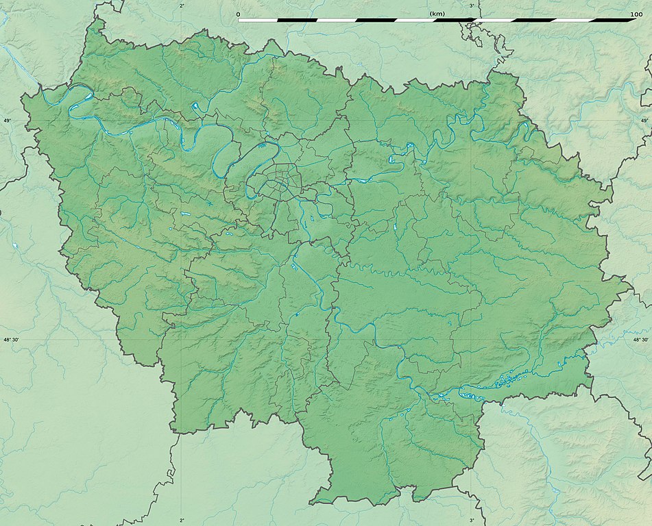
English: Blank physical map of the region of Île-de-France, France, as in January 2015, for geo-location purpose, with distinct boundaries for regions, departments and arrondissements.
Français : Carte physique vierge de la région Île-de-France, France, telle qu'en janvier 2015, destinée à la géolocalisation, avec limite distincte des régions, départements et arrondissements. Scale:
Equirectangular projection, WGS84 datum
Geographic limits of the map:
|
||
| ତାରିଖ | |||
| ମୂଳାଧାର |
ଆପଣା କାମ
|
||
| ଲେଖକ | Eric Gaba (Sting - fr:Sting) | ||
| ଅନୁମତି (ଏହି ଫାଇଲକୁ ପୁଣି ବ୍ୟବହାର କରିବେ) |
|
||
| ଅନ୍ୟ ସଂସ୍କରଣ |
|

ସତ୍ଵ
Eric Gaba, Wikimedia Commons user Sting, ଏହି କାମର ସତ୍ଵାଧିକାରୀ, ଏଠାରେ ତଳଲିଖିତ ଲାଇସେନ୍ସ ଅଧୀନରେ ଏହାକୁ ପ୍ରକାଶ କଲେ:
ଏହି ଫାଇଲଟି କ୍ରିଏଟିଭ କମନ୍ସ ଅଧୀନରେ ଆଟ୍ରିବୁସନ ସେଆର-ଏଲାଇକ ୩.୦ ଅନପୋର୍ଟେଡ଼ ଲାଇସେନ୍ସରେ ପଞ୍ଜିକରଣ କରାଯାଇଅଛି ।
ଶ୍ରେୟ: Eric Gaba, Wikimedia Commons user Sting
- ଆପଣ ଆରାମରେ:
- ବାଣ୍ଟିପାରିବେ – କାମଟିକୁ ନକଲ କରିପାରିବେ, ବାଣ୍ଟିପାରିବେ ଓ ପ୍ରସାରଣ କରିପାରିବେ
- ମିଶାଇପାରିବେ – କାମଟି ଅଭିଯୋଜନ କରିପାରିବେ
- ତଳଲିଖିତ ସର୍ତ୍ତାବଳୀ ଅଧୀନରେ:
- ଶ୍ରେୟ – ଆପଣ ମନେ କରି ଏହି କାମର ଆବଶ୍ୟକୀୟ ଶ୍ରେୟ ମୂଳ ଗଢ଼ାଳି ବା ସ୍ୱତ୍ୱାଧୀକାରୀଙ୍କୁ ଦେବେ ଏବଂ ଦେଲାବେଳେ ଲାଇସେନ୍ସର ଲିଙ୍କ ଦେଇ କି କି ବଦଳ କଲେ ଉଲ୍ଲେଖ କରିବେ । ଏହା ଉପଯୁକ୍ତ ଢଙ୍ଗରେ କରିବେ କିନ୍ତୁ ଲାଇସେନ୍ସ ଦେଉଥିବା ବ୍ୟକ୍ତି ଆପଣଙ୍କ ପ୍ରଚାର କଲା ଭଳି କିଛି ଲେଖିବେ ନାହିଁ ।
- ସେଆର ଏଲାଇକ – ଯଦି ଆପଣ ଏହି କାମଟିକୁ ବଦଳାଇବେ, ରୂପାନ୍ତରଣ କରିବେ ବା ଏହାକୁ ନେଇ କିଛି ଗଢ଼ିବେ ତେବେ ଆପଣ ଏହାକୁ ଏକା ବା ଅଲଗା ଲାଇସେନ୍ସ ଭିତରେ ରଖିପାରିବେ ।
ଫାଇଲ ଇତିହାସ
ଏହା ଫାଇଲଟି ସେତେବେଳେ ଯେମିତି ଦିଶୁଥିଲା ତାହା ଦେଖିବା ପାଇଁ ତାରିଖ/ବେଳା ଉପରେ କ୍ଲିକ କରନ୍ତୁ
| ତାରିଖ/ବେଳ | ନଖ ଦେଖଣା | ଆକାର | ବ୍ୟବହାରକାରୀ | ମତାମତ | |
|---|---|---|---|---|---|
| ଏବେକାର | ୨୧:୦୨, ୧୨ ଫେବୃଆରୀ ୨୦୧୫ | | ୧,୬୫୧ × ୧,୩୩୪ (୫୫୨ KB) | Sting | Color profile |
| ୨୦:୫୧, ୧୨ ଫେବୃଆରୀ ୨୦୧୫ |  | ୧,୬୫୧ × ୧,୩୩୪ (୫୩୭ KB) | Sting | Boundaries correction | |
| ୨୧:୫୬, ୨୨ ଜାନୁଆରୀ ୨୦୧୫ |  | ୧,୬୫୧ × ୧,୩୩୪ (୬୦୫ KB) | Sting | Boundaries correction | |
| ୧୯:୨୭, ୨୧ ଜାନୁଆରୀ ୨୦୧୫ |  | ୧,୬୫୧ × ୧,୩୩୪ (୫୯୮ KB) | Sting | == {{int:filedesc}} == {{Location|48|40|30|N|02|30|00|E|scale:1000000}} {{Information |Description={{en|Blank physical map of the region of Île-de-France, France, as in January 2015, for geo-location purpose, with distinct bound... |
ଫାଇଲ ବ୍ୟବହାର
ଏହି ସବୁପୃଷ୍ଠା ଏହି ଫାଇଲଟିକୁ ଯୋଡ଼ିଥାନ୍ତି:
ଜଗତ ଫାଇଲ ବ୍ୟବହାର
ତଳଲିଖିତ ଉଇକିସବୁ ଏହି ଫାଇଲଟିକୁ ବ୍ୟବହାର କରିଥାନ୍ତି:
- als.wikipedia.orgରେ ବ୍ୟବହାର
- ast.wikipedia.orgରେ ବ୍ୟବହାର
- ban.wikipedia.orgରେ ବ୍ୟବହାର
- bg.wikipedia.orgରେ ବ୍ୟବହାର
- Париж
- Версай
- Курбьовоа
- Ньой сюр Сен
- Сюрен
- Булон Биянкур
- Со
- Аниер сюр Сен
- Бобини
- Мол (Франция)
- Самоа сюр Сен
- Аржантьой
- Фонтенбло
- Епине сюр Сен
- Вил д'Авре
- Сен Жермен ан Ле
- Сен Дени
- Иври сюр Сен
- Екол политекник
- Вилжуиф
- Монтрьой
- Нантер
- Кретей
- Олне су Боа
- Витри сюр Сен
- Коломб
- Шампини сюр Марн
- Рюей Малмезон
- Сен Мор де Фосе
- Шаблон:ПК Франция Ил дьо Франс
- Жоанвил льо Пон
- Монфермей
- Есман
- Етамп
- Удан
- Мелюн
- Аверн
- Барбизон
- Обержанвил
- Епон
- Монтро Фот Йон
- Маси
- Монжерон
- Сен Морис (Ил дьо Франс)
- Армантиер ан Бри
- Мо
ଏହି ଫାଇଲଟିର ଅଧିକ ବିଶ୍ୱବ୍ୟାପୀ ବ୍ୟବହାର ଦେଖନ୍ତୁ ।