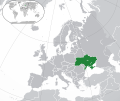
ଫାଇଲ:Europe-Ukraine.svg

Size of this PNG preview of this SVG file: ୭୧୩ × ୬୦୦ ପିକ୍ସେଲ. ବାକି ରେଜୋଲୁସନ: ୨୮୫ × ୨୪୦ ପିକ୍ସେଲ | ୫୭୧ × ୪୮୦ ପିକ୍ସେଲ | ୯୧୩ × ୭୬୮ ପିକ୍ସେଲ | ୧,୨୧୮ × ୧,୦୨୪ ପିକ୍ସେଲ | ୨,୪୩୫ × ୨,୦୪୮ ପିକ୍ସେଲ | ୨,୦୪୫ × ୧,୭୨୦ ପିକ୍ସେଲ.
ମୂଳ ଫାଇଲ (SVG ଫାଇଲ, ସାଧାରଣ ମାପ ୨,୦୪୫ × ୧,୭୨୦ ପିକ୍ସେଲ, ଫାଇଲ ଆକାର: ୭.୩୩ MB)
ଫାଇଲ ଇତିହାସ
ଏହା ଫାଇଲଟି ସେତେବେଳେ ଯେମିତି ଦିଶୁଥିଲା ତାହା ଦେଖିବା ପାଇଁ ତାରିଖ/ବେଳା ଉପରେ କ୍ଲିକ କରନ୍ତୁ
| ତାରିଖ/ବେଳ | ନଖ ଦେଖଣା | ଆକାର | ବ୍ୟବହାରକାରୀ | ମତାମତ | |
|---|---|---|---|---|---|
| ଏବେକାର | ୨୨:୪୯, ୧୨ ଡିସେମ୍ବର ୨୦୨୨ |  | ୨,୦୪୫ × ୧,୭୨୦ (୭.୩୩ MB) | Alexassandro | Reverted to version as of 14:22, 11 August 2015 (UTC) |
| ୦୬:୪୮, ୧୦ ମାର୍ଚ୍ଚ ୨୦୧୭ |  | ୨,୦୪୫ × ୧,୭୨୦ (୭.୩୪ MB) | Geom10 | fixed disputed borders | |
| ୧୯:୫୨, ୧୧ ଅଗଷ୍ଟ ୨୦୧୫ |  | ୨,୦୪୫ × ୧,୭୨୦ (୭.୩୩ MB) | Seryo93 | border is suitable for uncontrolled-territory variant | |
| ୧୩:୫୯, ୧୧ ଅଗଷ୍ଟ ୨୦୧୫ |  | ୨,୦୪୫ × ୧,୭୨୦ (୭.୩୩ MB) | Seryo93 | Second attempt at uploading | |
| ୧୩:୫୪, ୧୧ ଅଗଷ୍ଟ ୨୦୧୫ |  | ୨,୦୪୫ × ୧,୭୨୦ (୭.୩୩ MB) | Seryo93 | Isthmus of Perekop was too wide. Updated to match File:Europe-Ukraine (disputed territory).svg (except colour, of course) | |
| ୨୧:୩୩, ୧୯ ମାର୍ଚ୍ଚ ୨୦୧୪ |  | ୨,୦୪୫ × ୧,୭୨୦ (୨.୭ MB) | A.Savin | Reverted to pre-editwar state | |
| ୦୧:୩୬, ୧୯ ମାର୍ଚ୍ଚ ୨୦୧୪ |  | ୨,୦୪୫ × ୧,୭୨୦ (୨.୭୧ MB) | Артур михайлович | Reverted to version as of 17:05, 18 March 2014 | |
| ୨୨:୩୬, ୧୮ ମାର୍ଚ୍ଚ ୨୦୧୪ |  | ୨,୦୪୫ × ୧,୭୨୦ (୨.୭୧ MB) | Misha motsniy | по примеру с оккупироваными териториями Грузии и Кипра | |
| ୨୨:୩୫, ୧୮ ମାର୍ଚ୍ଚ ୨୦୧୪ |  | ୨,୦୪୫ × ୧,୭୨୦ (୨.୭୧ MB) | Misha motsniy | по примеру с оккупироваными териториями Грузии и Кипра | |
| ୨୨:୩୪, ୧୮ ମାର୍ଚ୍ଚ ୨୦୧୪ |  | ୨,୦୪୫ × ୧,୭୨୦ (୨.୭୧ MB) | Misha motsniy | по примеру с оккупироваными териториями Грузии и Кипра |
ଫାଇଲ ବ୍ୟବହାର
ଏହି ଫାଇଲ ସହିତ ଯୋଡ଼ା ଗୋଟିଏ ବି ପୃଷ୍ଠା ନାହିଁ ।
ଜଗତ ଫାଇଲ ବ୍ୟବହାର
ତଳଲିଖିତ ଉଇକିସବୁ ଏହି ଫାଇଲଟିକୁ ବ୍ୟବହାର କରିଥାନ୍ତି:
- ady.wikipedia.orgରେ ବ୍ୟବହାର
- af.wikipedia.orgରେ ବ୍ୟବହାର
- af.wiktionary.orgରେ ବ୍ୟବହାର
- ami.wikipedia.orgରେ ବ୍ୟବହାର
- am.wikipedia.orgରେ ବ୍ୟବହାର
- ang.wikipedia.orgରେ ବ୍ୟବହାର
- arc.wikipedia.orgରେ ବ୍ୟବହାର
- ar.wikipedia.orgରେ ବ୍ୟବହାର
- av.wikipedia.orgରେ ବ୍ୟବହାର
- awa.wikipedia.orgରେ ବ୍ୟବହାର
- az.wiktionary.orgରେ ବ୍ୟବହାର
- ba.wikipedia.orgରେ ବ୍ୟବହାର
- bbc.wikipedia.orgରେ ବ୍ୟବହାର
- be-tarask.wikipedia.orgରେ ବ୍ୟବହାର
- be.wikipedia.orgରେ ବ୍ୟବହାର
- crh.wikipedia.orgରେ ବ୍ୟବହାର
- cu.wikipedia.orgରେ ବ୍ୟବହାର
- dag.wikipedia.orgରେ ବ୍ୟବହାର
- da.wikipedia.orgରେ ବ୍ୟବହାର
- din.wikipedia.orgରେ ବ୍ୟବହାର
- en.wikipedia.orgରେ ବ୍ୟବହାର
- es.wikipedia.orgରେ ବ୍ୟବହାର
- fi.wikipedia.orgରେ ବ୍ୟବହାର
- fj.wikipedia.orgରେ ବ୍ୟବହାର
- gcr.wikipedia.orgରେ ବ୍ୟବହାର
- hr.wikipedia.orgରେ ବ୍ୟବହାର
- incubator.wikimedia.orgରେ ବ୍ୟବହାର
- inh.wikipedia.orgରେ ବ୍ୟବହାର
- it.wikipedia.orgରେ ବ୍ୟବହାର
- jam.wikipedia.orgରେ ବ୍ୟବହାର
- ja.wikipedia.orgରେ ବ୍ୟବହାର
- ka.wikipedia.orgରେ ବ୍ୟବହାର
- kg.wikipedia.orgରେ ବ୍ୟବହାର
- li.wikipedia.orgରେ ବ୍ୟବହାର
- lo.wikipedia.orgରେ ବ୍ୟବହାର
- lt.wikipedia.orgରେ ବ୍ୟବହାର
ଏହି ଫାଇଲଟିର ଅଧିକ ବିଶ୍ୱବ୍ୟାପୀ ବ୍ୟବହାର ଦେଖନ୍ତୁ ।

