
ଫାଇଲ:Cardiff UK relief location map.jpg

ଏହି ଦେଖଣାର ଆକାର: ୫୬୧ × ୫୯୯ ପିକ୍ସେଲ । ବାକି ରେଜୋଲୁସନ: ୨୨୫ × ୨୪୦ ପିକ୍ସେଲ | ୪୫୦ × ୪୮୦ ପିକ୍ସେଲ | ୭୧୯ × ୭୬୮ ପିକ୍ସେଲ | ୯୫୯ × ୧,୦୨୪ ପିକ୍ସେଲ | ୨,୦୧୦ × ୨,୧୪୬ ପିକ୍ସେଲ.
ମୂଳ ଫାଇଲ (୨,୦୧୦ × ୨,୧୪୬ ପିକସେଲ, ଫାଇଲ ଆକାର: ୨୫୪ KB, ଏମ.ଆଇ.ଏମ.ଇର ପ୍ରକାର: image/jpeg)
This is a file from the Wikimedia Commons. Information from its description page there is shown below. |
| ବିବରଣୀ |
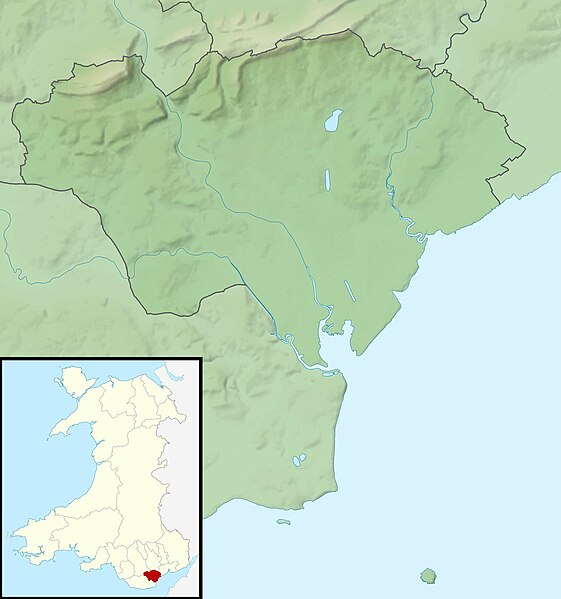
Relief map of Cardiff, UK. Equirectangular map projection on WGS 84 datum, with N/S stretched 160% Geographic limits:
|
| ତାରିଖ | |
| ମୂଳାଧାର |
|
| ଲେଖକ | Nilfanion, created using Ordnance Survey data |
| ଅନୁମତି (ଏହି ଫାଇଲକୁ ପୁଣି ବ୍ୟବହାର କରିବେ) |
ଏହି ଫାଇଲଟି କ୍ରିଏଟିଭ କମନ୍ସ ଅଧୀନରେ ଆଟ୍ରିବୁସନ ସେଆର-ଏଲାଇକ ୩.୦ ଅନପୋର୍ଟେଡ଼ ଲାଇସେନ୍ସରେ ପଞ୍ଜିକରଣ କରାଯାଇଅଛି । ଶ୍ରେୟ: Contains Ordnance Survey data © Crown copyright and database right
|
| ଅନ୍ୟ ସଂସ୍କରଣ | File:Cardiff UK map.svg - Blank map |
ଫାଇଲ ଇତିହାସ
ଏହା ଫାଇଲଟି ସେତେବେଳେ ଯେମିତି ଦିଶୁଥିଲା ତାହା ଦେଖିବା ପାଇଁ ତାରିଖ/ବେଳା ଉପରେ କ୍ଲିକ କରନ୍ତୁ
| ତାରିଖ/ବେଳ | ନଖ ଦେଖଣା | ଆକାର | ବ୍ୟବହାରକାରୀ | ମତାମତ | |
|---|---|---|---|---|---|
| ଏବେକାର | ୦୬:୨୬, ୩୦ ନଭେମ୍ବର ୨୦୧୧ | | ୨,୦୧୦ × ୨,୧୪୬ (୨୫୪ KB) | Nilfanion | {{Information |Description=Relief map of Cardiff, UK. Equirectangular map projection on WGS 84 datum, with N/S stretched 160% Geographic limits: *West: 3.35W *East: 3.05W *North: 51.57N *South: 51.37N |Source=[[w:Ordnance Survey|Ordnance S |
ଫାଇଲ ବ୍ୟବହାର
ଏହି ଫାଇଲ ସହିତ ଯୋଡ଼ା ଗୋଟିଏ ବି ପୃଷ୍ଠା ନାହିଁ ।
ଜଗତ ଫାଇଲ ବ୍ୟବହାର
ତଳଲିଖିତ ଉଇକିସବୁ ଏହି ଫାଇଲଟିକୁ ବ୍ୟବହାର କରିଥାନ୍ତି:
- ar.wikipedia.orgରେ ବ୍ୟବହାର
- ceb.wikipedia.orgରେ ବ୍ୟବହାର
- de.wikipedia.orgରେ ବ୍ୟବହାର
- el.wikipedia.orgରେ ବ୍ୟବହାର
- en.wikipedia.orgରେ ବ୍ୟବହାର
- St Padarn's Institute
- St Fagans Castle
- Animal Wall
- Llanishen Reservoir
- Module:Location map/data/Wales Cardiff/doc
- Lisvane Reservoir
- Bishop's Palace, Llandaff
- Wenallt Camp
- Jackson Hall, Cardiff
- Shah Jalal Mosque, Cardiff
- 6 High Street, Llandaff
- Module:Location map/data/Wales Cardiff
- Ty Bronna
- Craig-y-parc House
- Hayes Island Snack Bar
- Twmpath Castle
- Morganstown Castle Mound
- Caer Castell Camp
- St Andrew, Llandaff
- St Cross, Llandaff
- 19 High Street, Llandaff
- 2-4 High Street, Llandaff
- es.wikipedia.orgରେ ବ୍ୟବହାର
- fr.wikipedia.orgରେ ବ୍ୟବହାର
- he.wikipedia.orgରେ ବ୍ୟବହାର
- hu.wikipedia.orgରେ ବ୍ୟବହାର
- ja.wikipedia.orgରେ ବ୍ୟବହାର
- kn.wikipedia.orgରେ ବ୍ୟବହାର
- ko.wikipedia.orgରେ ବ୍ୟବହାର
- pl.wikipedia.orgରେ ବ୍ୟବହାର
- pl.wikibooks.orgରେ ବ୍ୟବହାର
- sh.wikipedia.orgରେ ବ୍ୟବହାର
- si.wikipedia.orgରେ ବ୍ୟବହାର
- tr.wikipedia.orgରେ ବ୍ୟବହାର
ଏହି ଫାଇଲଟିର ଅଧିକ ବିଶ୍ୱବ୍ୟାପୀ ବ୍ୟବହାର ଦେଖନ୍ତୁ ।