
ଫାଇଲ:Poland location map.svg

Size of this PNG preview of this SVG file: ୬୧୭ × ୬୦୦ ପିକ୍ସେଲ. ବାକି ରେଜୋଲୁସନ: ୨୪୭ × ୨୪୦ ପିକ୍ସେଲ | ୪୯୪ × ୪୮୦ ପିକ୍ସେଲ | ୭୯୦ × ୭୬୮ ପିକ୍ସେଲ | ୧,୦୫୩ × ୧,୦୨୪ ପିକ୍ସେଲ | ୨,୧୦୭ × ୨,୦୪୮ ପିକ୍ସେଲ | ୮୬୧ × ୮୩୭ ପିକ୍ସେଲ.
ମୂଳ ଫାଇଲ (SVG ଫାଇଲ, ସାଧାରଣ ମାପ ୮୬୧ × ୮୩୭ ପିକ୍ସେଲ, ଫାଇଲ ଆକାର: ୨୧୩ KB)
This is a file from the Wikimedia Commons. Information from its description page there is shown below. |
ସାରକଥା
| ବିବରଣୀ |
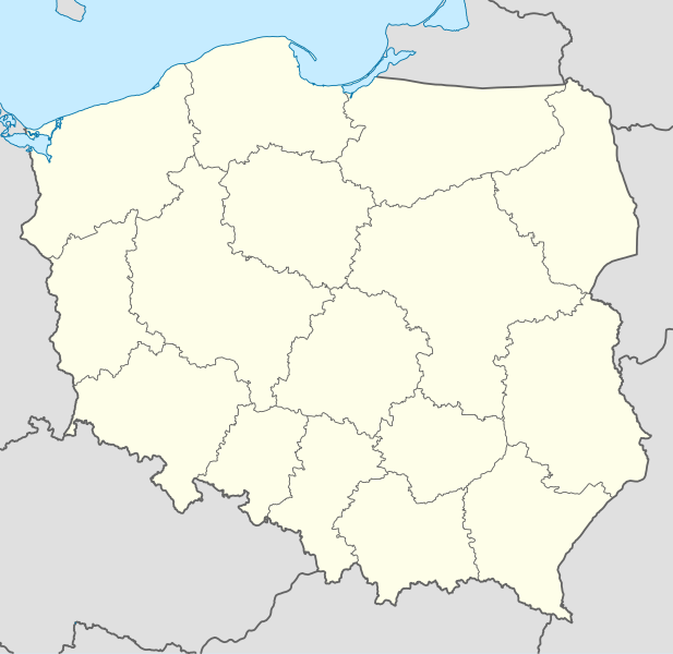
Deutsch: Positionskarte von Polen
Quadratische Plattkarte, N-S-Streckung 160 %. Geographische Begrenzung der Karte:
English: Location map of Poland
Equirectangular projection, N/S stretching 160 %. Geographic limits of the map:
|
||
| ତାରିଖ | |||
| ମୂଳାଧାର |
ଆପଣା କାମ using
|
||
| ଲେଖକ | NordNordWest | ||
| ଅନ୍ୟ ସଂସ୍କରଣ |
|
||
| SVG genesis | This W3C-invalid map was created with Adobe Illustrator.
|


ସତ୍ଵ
ମୁଁ, ଏହି କାମର ସତ୍ୱାଧିକାରୀ, ଏଠାରେ ତଳଲିଖିତ ଲାଇସେନ୍ସ ଅଧୀନରେ ଏହାକୁ ପ୍ରକାଶ କଲି:

|
ମାଗଣା ସଫ୍ଟବେର ଫାଉଣ୍ଡେସନ ଦେଇ ପ୍ରକାଶିତ କୌଣସି ବଦଳାଇ ନହେବା ଭଳି ଧାରା, ଆଗ ବା ପଛ ପଟ ମଲାଟ ବିନା GNU ଖୋଲା ଦଲିଲକାରଣ ଲାଇସେନ୍ସ ୧.୨ ତମ ସଙ୍କଳନ ବା ଆଉ କୌଣସି ସର୍ତ୍ତାବଳି ଅନୁସାରେ ଏହି ଦଲିଲର ନକଲ, ବଣ୍ଟନ ତଥା/କିମ୍ବା ବଦଳାଇବା ନିମନ୍ତେ ଅନୁମତି ଦିଆଗଲା । GNU ମାଗଣା ଦଲିଲକରଣ ଲାଇସେନ୍ସ ନାମକ ବିଭାଗରେ ଲାଇସେନ୍ସର ନକଲ ଦିଆଯାଇଅଛି । |
ଏହି ଫାଇଲଟି କ୍ରିଏଟିଭ କମନ୍ସ ଅଧୀନରେ ଆଟ୍ରିବୁସନ ସେଆର-ଏଲାଇକ ୩.୦ ଅନପୋର୍ଟେଡ଼ ଲାଇସେନ୍ସରେ ପଞ୍ଜିକରଣ କରାଯାଇଅଛି ।
- ଆପଣ ଆରାମରେ:
- ବାଣ୍ଟିପାରିବେ – କାମଟିକୁ ନକଲ କରିପାରିବେ, ବାଣ୍ଟିପାରିବେ ଓ ପ୍ରସାରଣ କରିପାରିବେ
- ମିଶାଇପାରିବେ – କାମଟି ଅଭିଯୋଜନ କରିପାରିବେ
- ତଳଲିଖିତ ସର୍ତ୍ତାବଳୀ ଅଧୀନରେ:
- ଶ୍ରେୟ – ଆପଣ ମନେ କରି ଏହି କାମର ଆବଶ୍ୟକୀୟ ଶ୍ରେୟ ମୂଳ ଗଢ଼ାଳି ବା ସ୍ୱତ୍ୱାଧୀକାରୀଙ୍କୁ ଦେବେ ଏବଂ ଦେଲାବେଳେ ଲାଇସେନ୍ସର ଲିଙ୍କ ଦେଇ କି କି ବଦଳ କଲେ ଉଲ୍ଲେଖ କରିବେ । ଏହା ଉପଯୁକ୍ତ ଢଙ୍ଗରେ କରିବେ କିନ୍ତୁ ଲାଇସେନ୍ସ ଦେଉଥିବା ବ୍ୟକ୍ତି ଆପଣଙ୍କ ପ୍ରଚାର କଲା ଭଳି କିଛି ଲେଖିବେ ନାହିଁ ।
- ସେଆର ଏଲାଇକ – ଯଦି ଆପଣ ଏହି କାମଟିକୁ ବଦଳାଇବେ, ରୂପାନ୍ତରଣ କରିବେ ବା ଏହାକୁ ନେଇ କିଛି ଗଢ଼ିବେ ତେବେ ଆପଣ ଏହାକୁ ଏକା ବା ଅଲଗା ଲାଇସେନ୍ସ ଭିତରେ ରଖିପାରିବେ ।
ଆପଣ ନିଜ ପସନ୍ଦର ଲାଇସେନ୍ସ ବାଛିପାରିବେ ।
ଫାଇଲ ଇତିହାସ
ଏହା ଫାଇଲଟି ସେତେବେଳେ ଯେମିତି ଦିଶୁଥିଲା ତାହା ଦେଖିବା ପାଇଁ ତାରିଖ/ବେଳା ଉପରେ କ୍ଲିକ କରନ୍ତୁ
| ତାରିଖ/ବେଳ | ନଖ ଦେଖଣା | ଆକାର | ବ୍ୟବହାରକାରୀ | ମତାମତ | |
|---|---|---|---|---|---|
| ଏବେକାର | ୧୮:୦୪, ୨ ଅକ୍ଟୋବର ୨୦୧୨ | | ୮୬୧ × ୮୩୭ (୨୧୩ KB) | Palosirkka | Reverted to version as of 20:23, 23 November 2011 Location maps must remain very accurate |
| ୦୨:୦୭, ୨ ଅକ୍ଟୋବର ୨୦୧୨ |  | ୮୬୧ × ୮୩୭ (୧୯୬ KB) | Palosirkka | Scrubbed with http://codedread.com/scour/ | |
| ୦୧:୫୩, ୨୪ ନଭେମ୍ବର ୨୦୧୧ |  | ୮୬୧ × ୮୩୭ (୨୧୩ KB) | NordNordWest | upd | |
| ୧୬:୫୮, ୮ ଡିସେମ୍ବର ୨୦୦୮ |  | ୮୬୨ × ୮୩୮ (୩୭୭ KB) | NordNordWest | Reverted to version as of 09:25, 8 July 2008, an often used image shouldn't be changed without discussion | |
| ୧୪:୫୬, ୮ ଡିସେମ୍ବର ୨୦୦୮ |  | ୮୬୨ × ୮୩୮ (୩୭୮ KB) | Mareklug | I made the featured background (territory of Poland) pure white for better contrast. | |
| ୧୪:୫୫, ୮ ଜୁଲାଇ ୨୦୦୮ |  | ୮୬୨ × ୮୩୮ (୩୭୭ KB) | NordNordWest | {{Information |Description= {{de|Positionskarte von Polen}} Quadratische Plattkarte, N-S-Streckung 160 %. Geographische Begrenzung der Karte: * N: 55.2° N * S: 48.7° N * W: 13.8° O * O: 24.5° O {{en|Location map of Poland} |
ଫାଇଲ ବ୍ୟବହାର
ଏହି ସବୁପୃଷ୍ଠା ଏହି ଫାଇଲଟିକୁ ଯୋଡ଼ିଥାନ୍ତି:
ଜଗତ ଫାଇଲ ବ୍ୟବହାର
ତଳଲିଖିତ ଉଇକିସବୁ ଏହି ଫାଇଲଟିକୁ ବ୍ୟବହାର କରିଥାନ୍ତି:
- ar.wikipedia.orgରେ ବ୍ୟବହାର
- av.wikipedia.orgରେ ବ୍ୟବହାର
- bn.wikipedia.orgରେ ବ୍ୟବହାର
- bs.wikipedia.orgରେ ବ୍ୟବହାର
- ceb.wikipedia.orgରେ ବ୍ୟବହାର
- ckb.wikipedia.orgରେ ବ୍ୟବହାର
- de.wikipedia.orgରେ ବ୍ୟବହାର
- diq.wikipedia.orgରେ ବ୍ୟବହାର
- el.wikipedia.orgରେ ବ୍ୟବହାର
- en.wikipedia.orgରେ ବ୍ୟବହାର
- en.wikivoyage.orgରେ ବ୍ୟବହାର
- en.wiktionary.orgରେ ବ୍ୟବହାର
- eo.wikipedia.orgରେ ବ୍ୟବହାର
- eo.wikivoyage.orgରେ ବ୍ୟବହାର
- es.wikipedia.orgରେ ବ୍ୟବହାର
- fa.wikipedia.orgରେ ବ୍ୟବହାର
- fo.wikipedia.orgରେ ବ୍ୟବହାର
- fr.wikipedia.orgରେ ବ୍ୟବହାର
- hr.wikipedia.orgରେ ବ୍ୟବହାର
- hsb.wikipedia.orgରେ ବ୍ୟବହାର
- hu.wikipedia.orgରେ ବ୍ୟବହାର
ଏହି ଫାଇଲଟିର ଅଧିକ ବିଶ୍ୱବ୍ୟାପୀ ବ୍ୟବହାର ଦେଖନ୍ତୁ ।