
ଫାଇଲ:India relief location map ganges highlighted.jpg

ଏହି ଦେଖଣାର ଆକାର: ୫୫୭ × ୬୦୦ ପିକ୍ସେଲ । ବାକି ରେଜୋଲୁସନ: ୨୨୩ × ୨୪୦ ପିକ୍ସେଲ | ୪୪୬ × ୪୮୦ ପିକ୍ସେଲ | ୭୧୩ × ୭୬୮ ପିକ୍ସେଲ | ୯୫୧ × ୧,୦୨୪ ପିକ୍ସେଲ | ୧,୫୦୦ × ୧,୬୧୫ ପିକ୍ସେଲ.
ମୂଳ ଫାଇଲ (୧,୫୦୦ × ୧,୬୧୫ ପିକସେଲ, ଫାଇଲ ଆକାର: ୬୧୭ KB, ଏମ.ଆଇ.ଏମ.ଇର ପ୍ରକାର: image/jpeg)
This is a file from the Wikimedia Commons. Information from its description page there is shown below. |
ସାରକଥା
| ବିବରଣୀ |
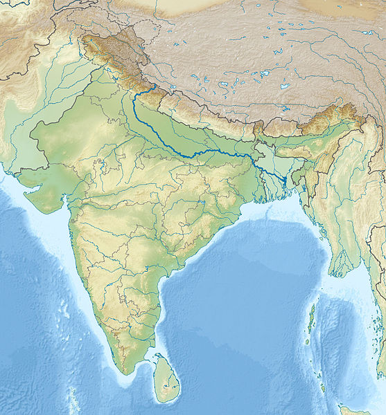
English: Location map of India with the Ganges highlighted. This can be an alternative map to be used with Template:Location map India. Equirectangular projection. Geographic limits of the map: top=37.5, bottom=5.0, left=67.0, right=99.0 |
| ତାରିଖ | (UTC) |
| ମୂଳାଧାର | |
| ଲେଖକ |
|
| This is a retouched picture, which means that it has been digitally altered from its original version. The original can be viewed here: India relief location map.jpg:
|
ସତ୍ଵ
ମୁଁ, ଏହି କାମର ସତ୍ୱାଧିକାରୀ, ଏଠାରେ ତଳଲିଖିତ ଲାଇସେନ୍ସ ଅଧୀନରେ ଏହାକୁ ପ୍ରକାଶ କଲି:
ଏହି ଫାଇଲଟି କ୍ରିଏଟିଭ କମନ୍ସ ଅଧୀନରେ ଆଟ୍ରିବୁସନ ସେଆର-ଏଲାଇକ ୩.୦ ଅନପୋର୍ଟେଡ଼ ଲାଇସେନ୍ସରେ ପଞ୍ଜିକରଣ କରାଯାଇଅଛି ।
- ଆପଣ ଆରାମରେ:
- ବାଣ୍ଟିପାରିବେ – କାମଟିକୁ ନକଲ କରିପାରିବେ, ବାଣ୍ଟିପାରିବେ ଓ ପ୍ରସାରଣ କରିପାରିବେ
- ମିଶାଇପାରିବେ – କାମଟି ଅଭିଯୋଜନ କରିପାରିବେ
- ତଳଲିଖିତ ସର୍ତ୍ତାବଳୀ ଅଧୀନରେ:
- ଶ୍ରେୟ – ଆପଣ ମନେ କରି ଏହି କାମର ଆବଶ୍ୟକୀୟ ଶ୍ରେୟ ମୂଳ ଗଢ଼ାଳି ବା ସ୍ୱତ୍ୱାଧୀକାରୀଙ୍କୁ ଦେବେ ଏବଂ ଦେଲାବେଳେ ଲାଇସେନ୍ସର ଲିଙ୍କ ଦେଇ କି କି ବଦଳ କଲେ ଉଲ୍ଲେଖ କରିବେ । ଏହା ଉପଯୁକ୍ତ ଢଙ୍ଗରେ କରିବେ କିନ୍ତୁ ଲାଇସେନ୍ସ ଦେଉଥିବା ବ୍ୟକ୍ତି ଆପଣଙ୍କ ପ୍ରଚାର କଲା ଭଳି କିଛି ଲେଖିବେ ନାହିଁ ।
- ସେଆର ଏଲାଇକ – ଯଦି ଆପଣ ଏହି କାମଟିକୁ ବଦଳାଇବେ, ରୂପାନ୍ତରଣ କରିବେ ବା ଏହାକୁ ନେଇ କିଛି ଗଢ଼ିବେ ତେବେ ଆପଣ ଏହାକୁ ଏକା ବା ଅଲଗା ଲାଇସେନ୍ସ ଭିତରେ ରଖିପାରିବେ ।

|
ମାଗଣା ସଫ୍ଟବେର ଫାଉଣ୍ଡେସନ ଦେଇ ପ୍ରକାଶିତ କୌଣସି ବଦଳାଇ ନହେବା ଭଳି ଧାରା, ଆଗ ବା ପଛ ପଟ ମଲାଟ ବିନା GNU ଖୋଲା ଦଲିଲକାରଣ ଲାଇସେନ୍ସ ୧.୨ ତମ ସଙ୍କଳନ ବା ଆଉ କୌଣସି ସର୍ତ୍ତାବଳି ଅନୁସାରେ ଏହି ଦଲିଲର ନକଲ, ବଣ୍ଟନ ତଥା/କିମ୍ବା ବଦଳାଇବା ନିମନ୍ତେ ଅନୁମତି ଦିଆଗଲା । GNU ମାଗଣା ଦଲିଲକରଣ ଲାଇସେନ୍ସ ନାମକ ବିଭାଗରେ ଲାଇସେନ୍ସର ନକଲ ଦିଆଯାଇଅଛି । |
ଆପଣ ନିଜ ପସନ୍ଦର ଲାଇସେନ୍ସ ବାଛିପାରିବେ ।
ମୂଲ ଅପଲୋଡ଼ ଫାଇଲ
This image is a derivative work of the following images:
- File:India_relief_location_map.jpg licensed with Cc-by-sa-3.0, GFDL
- 2010-04-23T15:31:11Z Uwe Dedering 1500x1615 (2100573 Bytes) {{Information |Description={{en|1=Location map of India. Equirectangular projection. Strechted by 106.0%. Geographic limits of the map: * N: 37.5° N * S: 5.0° N * W: 67.0° E * E: 99.0° E Made with Natural Earth. Free vect
Uploaded with derivativeFX
ଫାଇଲ ଇତିହାସ
ଏହା ଫାଇଲଟି ସେତେବେଳେ ଯେମିତି ଦିଶୁଥିଲା ତାହା ଦେଖିବା ପାଇଁ ତାରିଖ/ବେଳା ଉପରେ କ୍ଲିକ କରନ୍ତୁ
| ତାରିଖ/ବେଳ | ନଖ ଦେଖଣା | ଆକାର | ବ୍ୟବହାରକାରୀ | ମତାମତ | |
|---|---|---|---|---|---|
| ଏବେକାର | ୦୦:୩୨, ୧୮ ନଭେମ୍ବର ୨୦୧୦ | | ୧,୫୦୦ × ୧,୬୧୫ (୬୧୭ KB) | 배우는사람 | {{Information |Description={{en|1=Location map of India with the Ganges highlighted. This can be an alternative map to be used with Template:Location map India.}} |Source=*File:India_relief_location_map.jpg |Dat |
ଫାଇଲ ବ୍ୟବହାର
ଏହି ସବୁ2 ପୃଷ୍ଠାସବୁ ଏହି ଫାଇଲଟିକୁ ଯୋଡ଼ିଥାନ୍ତି:
ଜଗତ ଫାଇଲ ବ୍ୟବହାର
ତଳଲିଖିତ ଉଇକିସବୁ ଏହି ଫାଇଲଟିକୁ ବ୍ୟବହାର କରିଥାନ୍ତି:
- ace.wikipedia.orgରେ ବ୍ୟବହାର
- ar.wikipedia.orgରେ ବ୍ୟବହାର
- azb.wikipedia.orgରେ ବ୍ୟବହାର
- bn.wikipedia.orgରେ ବ୍ୟବହାର
- bs.wikipedia.orgରେ ବ୍ୟବହାର
- bug.wikipedia.orgରେ ବ୍ୟବହାର
- ceb.wikipedia.orgରେ ବ୍ୟବହାର
- ckb.wikipedia.orgରେ ବ୍ୟବହାର
- diq.wikipedia.orgରେ ବ୍ୟବହାର
- dty.wikipedia.orgରେ ବ୍ୟବହାର
- dv.wikipedia.orgରେ ବ୍ୟବହାର
- el.wikipedia.orgରେ ବ୍ୟବହାର
- en.wikipedia.orgରେ ବ୍ୟବହାର
- eo.wikipedia.orgରେ ବ୍ୟବହାର
- Kolkato
- Nov-Delhio
- Mumbajo
- Taĝ-Mahalo
- Delhio
- Sentinelanoj
- Dezerto Tar
- Agra
- Prajagraĝo
- Kanpur
- Gaziabad
- Ĉandigaro
- Ŝablono:Geokesto lokumilo Barato
- Novmumbajo
- Gvalior
- Maduraj
- Hubli
- Ĝalandar
- Salem (Barato)
- Aligor
- Kota (Raĝastano)
- Barejli
- Tiruĉirapali
- Moradabad
- Gorakhpur
- Ĝamŝedpur
- Bikaner
- Koĉi (Barato)
- Raĝpur Sonarpur
- Siliguri
- Kolhapur
- Sangli
- Aĝmer
ଏହି ଫାଇଲଟିର ଅଧିକ ବିଶ୍ୱବ୍ୟାପୀ ବ୍ୟବହାର ଦେଖନ୍ତୁ ।