
ଫାଇଲ:Odisha locator map.svg

ମୂଳ ଫାଇଲ (SVG ଫାଇଲ, ସାଧାରଣ ମାପ ୨,୨୬୯ × ୨,୨୪୧ ପିକ୍ସେଲ, ଫାଇଲ ଆକାର: ୨୧୧ KB)
This is a file from the Wikimedia Commons. Information from its description page there is shown below. |
| ଶିରୋନାମ |
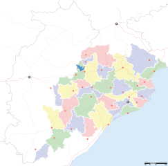
Orissa locator map |
||
| Description |
Locator map for the Indian state of w:Orissa. Equirectangular projection - Geographic limits of the map: top=24.27, bottom=17.691 |
||
| ତାରିଖ | |||
| ମୂଳାଧାର |
ଆପଣା କାମ |
||
| Creator |
|
||
| ଅନୁମତି (ଏହି ଫାଇଲକୁ ପୁଣି ବ୍ୟବହାର କରିବେ) |
ମୁଁ, ଏହି କାମର ସତ୍ଵାଧିକାରୀ, ଏଠାରେ ତଳଲିଖିତ ଲାଇସେନ୍ସ ଅଧୀନରେ ଏହାକୁ ପ୍ରକାଶ କଲି: ଏହି ଫାଇଲଟି କ୍ରିଏଟିଭ କମନ୍ସ ଅଧୀନରେ ଆଟ୍ରିବୁସନ ସେଆର-ଏଲାଇକ ୩.୦ ଅନପୋର୍ଟେଡ଼ ଲାଇସେନ୍ସରେ ପଞ୍ଜିକରଣ କରାଯାଇଅଛି ।
|
||
| Geotemporal data | |||
| Date depicted | second half of 20 century ଓ 21 century | ||
| Georeferencing | If inappropriate please set warp_status = skip to hide. | ||
| Archival data | |||
| ଟୀକା | Part of WikiProject India Maps | ||
ଫାଇଲ ଇତିହାସ
ଏହା ଫାଇଲଟି ସେତେବେଳେ ଯେମିତି ଦିଶୁଥିଲା ତାହା ଦେଖିବା ପାଇଁ ତାରିଖ/ବେଳା ଉପରେ କ୍ଲିକ କରନ୍ତୁ
| ତାରିଖ/ବେଳ | ନଖ ଦେଖଣା | ଆକାର | ବ୍ୟବହାରକାରୀ | ମତାମତ | |
|---|---|---|---|---|---|
| ଏବେକାର | ୨୨:୫୮, ୬ ସେପ୍ଟେମ୍ବର ୨୦୦୮ | | ୨,୨୬୯ × ୨,୨୪୧ (୨୧୧ KB) | Planemad | |
| ୧୮:୫୮, ୨୧ ଫେବୃଆରୀ ୨୦୦୮ |  | ୬୪୭ × ୫୬୪ (୧୩୨ KB) | Mkeranat~commonswiki | {{Information |Description=Locator map for the state of [w:Orissa] updated to show white borders for districts |Source=self-made, based on India locator map by [w:User:Planemad] |Date=Feb 2008 |Author= Mkeranat |Permission= |other_versions= }} | |
| ୦୩:୦୨, ୧୫ ଫେବୃଆରୀ ୨୦୦୮ |  | ୬୪୭ × ୫୬୪ (୧୩୦ KB) | Mkeranat~commonswiki | {{Information |Description=Locator map for the state of [w:Orissa] |Source=self-made, based on India locator map by [w:User:Planemad] |Date=Feb 2008 |Author= Mkeranat |Permission= |other_versions= }} |
ଫାଇଲ ବ୍ୟବହାର
ଏହି ସବୁ31 ପୃଷ୍ଠାସବୁ ଏହି ଫାଇଲଟିକୁ ଯୋଡ଼ିଥାନ୍ତି:
- ଆଠଗଡ଼
- ଆନନ୍ଦପୁର
- ଆସିକା
- ଓଡ଼ିଶା ବିଧାନ ସଭା ନିର୍ବାଚନ, ୨୦୦୯
- କଦ୍ଦମ ରସୁଲ
- କୋଣାର୍କ
- ଗୁଣପୁର
- ଚାନ୍ଦିପୁର
- ଜଳେଶ୍ୱର
- ଜୁନାଗଡ଼, କଳାହାଣ୍ଡି
- ତାଳଚେର
- ଧାମରା
- ନିମାପଡ଼ା
- ପଦ୍ମପୁର
- ପୁଷ୍ପଗିରି ମହାବିହାର
- ବାଙ୍କୀ
- ବାଙ୍ଗିରିପୋଷି
- ବାରବାଟି ଦୁର୍ଗ
- ବାଲିଗୁଡ଼ା
- ବାଲେଶ୍ଵର (ଲୋକ ସଭା ନିର୍ବାଚନ ମଣ୍ଡଳୀ)
- ବିଷମ କଟକ
- ବେଲପାହାଡ଼
- ବେହେରା
- ବ୍ରହ୍ମଗିରି
- ବ୍ୟାସନଗର
- ଭଦ୍ରକ
- ଭୁବନ
- ଯୋଡ଼ା
- ରେଢ଼ାଖୋଲ
- ସେରଗଡ଼, ବାଲେଶ୍ୱର
- ଛାଞ୍ଚ:Location map India Odisha
ଜଗତ ଫାଇଲ ବ୍ୟବହାର
ତଳଲିଖିତ ଉଇକିସବୁ ଏହି ଫାଇଲଟିକୁ ବ୍ୟବହାର କରିଥାନ୍ତି:
- ar.wikipedia.orgରେ ବ୍ୟବହାର
- as.wikipedia.orgରେ ବ୍ୟବହାର
- awa.wikipedia.orgରେ ବ୍ୟବହାର
- ba.wikipedia.orgରେ ବ୍ୟବହାର
- ceb.wikipedia.orgରେ ବ୍ୟବହାର
- de.wikipedia.orgରେ ବ୍ୟବହାର
- en.wikipedia.orgରେ ବ୍ୟବହାର
- es.wikipedia.orgରେ ବ୍ୟବହାର
- fa.wikipedia.orgରେ ବ୍ୟବହାର
- gu.wikipedia.orgରେ ବ୍ୟବହାର
- hi.wikipedia.orgରେ ବ୍ୟବହାର
- नलबण पक्षी अभयारण्य
- साँचा:ओड़िशा के लोकसभा निर्वाचन क्षेत्र
- आस्का लोक सभा निर्वाचन क्षेत्र
- भुवनेश्वर लोक सभा निर्वाचन क्षेत्र
- बलांगिर लोक सभा निर्वाचन क्षेत्र
- कटक लोक सभा निर्वाचन क्षेत्र
- ढेंकानाल लोक सभा निर्वाचन क्षेत्र
- जगतसिंहपुर लोक सभा निर्वाचन क्षेत्र
- जाजपुर लोक सभा निर्वाचन क्षेत्र
- कलाहांडी लोक सभा निर्वाचन क्षेत्र
- कंधमाल लोक सभा निर्वाचन क्षेत्र
ଏହି ଫାଇଲଟିର ଅଧିକ ବିଶ୍ୱବ୍ୟାପୀ ବ୍ୟବହାର ଦେଖନ୍ତୁ ।