
ଫାଇଲ:France location map-Regions and departements-2015.svg

Size of this PNG preview of this SVG file: ୬୨୪ × ୬୦୦ ପିକ୍ସେଲ. ବାକି ରେଜୋଲୁସନ: ୨୫୦ × ୨୪୦ ପିକ୍ସେଲ | ୪୯୯ × ୪୮୦ ପିକ୍ସେଲ | ୭୯୯ × ୭୬୮ ପିକ୍ସେଲ | ୧,୦୬୬ × ୧,୦୨୪ ପିକ୍ସେଲ | ୨,୧୩୧ × ୨,୦୪୮ ପିକ୍ସେଲ | ୨,୦୦୦ × ୧,୯୨୨ ପିକ୍ସେଲ.
ମୂଳ ଫାଇଲ (SVG ଫାଇଲ, ସାଧାରଣ ମାପ ୨,୦୦୦ × ୧,୯୨୨ ପିକ୍ସେଲ, ଫାଇଲ ଆକାର: ୬୯୯ KB)
This is a file from the Wikimedia Commons. Information from its description page there is shown below. |
ସାରକଥା
| ବିବରଣୀ |
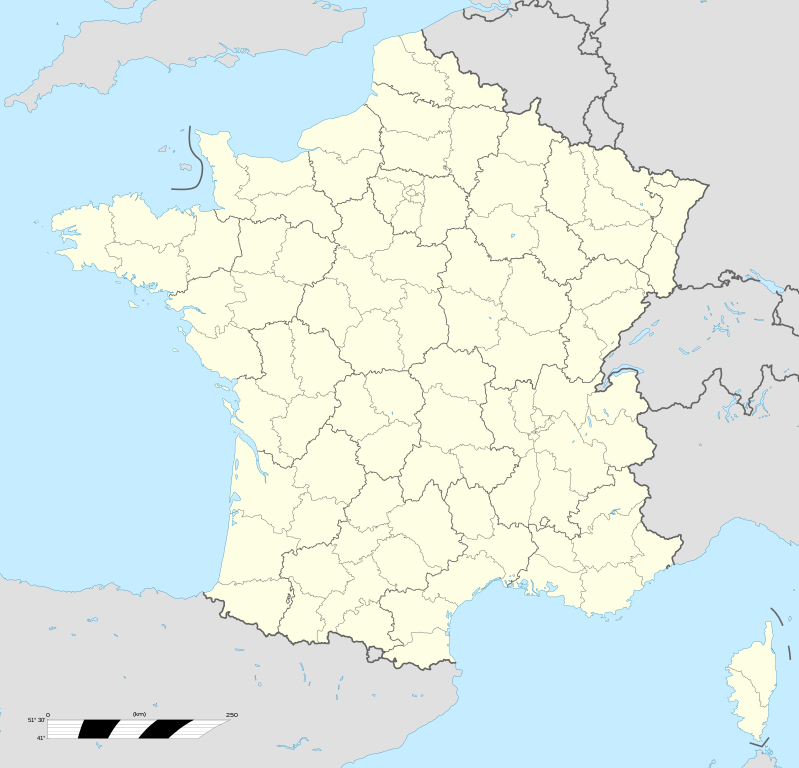
English: Blank administrative map of France for geo-location purpose, with regions and departements distinguished. Approximate scale : 1:3,000,000 Français : Carte administrative vierge de la France destinée à la géolocalisation, avec régions et départements distingués.
Échelle approximative : 1:3 000 000 Equirectangular projection, WGS84 datum
Geographic limits of the map :
|
| ତାରିଖ | |
| ମୂଳାଧାର |
Own work based on: France location map-Regions and departements.svg
|
| ଲେଖକ | Eric Gaba (Sting - fr:Sting); Ajout Métropole de Lyon: Otourly |
| ଅନ୍ୟ ସଂସ୍କରଣ |
|
| SVG genesis |


.svg)
| Object location | | View this and other nearby images on: OpenStreetMap |
|---|
ସତ୍ଵ
ମୁଁ, ଏହି କାମର ସତ୍ୱାଧିକାରୀ, ଏଠାରେ ତଳଲିଖିତ ଲାଇସେନ୍ସ ଅଧୀନରେ ଏହାକୁ ପ୍ରକାଶ କଲି:

|
ମାଗଣା ସଫ୍ଟବେର ଫାଉଣ୍ଡେସନ ଦେଇ ପ୍ରକାଶିତ କୌଣସି ବଦଳାଇ ନହେବା ଭଳି ଧାରା, ଆଗ ବା ପଛ ପଟ ମଲାଟ ବିନା GNU ଖୋଲା ଦଲିଲକାରଣ ଲାଇସେନ୍ସ ୧.୨ ତମ ସଙ୍କଳନ ବା ଆଉ କୌଣସି ସର୍ତ୍ତାବଳି ଅନୁସାରେ ଏହି ଦଲିଲର ନକଲ, ବଣ୍ଟନ ତଥା/କିମ୍ବା ବଦଳାଇବା ନିମନ୍ତେ ଅନୁମତି ଦିଆଗଲା । GNU ମାଗଣା ଦଲିଲକରଣ ଲାଇସେନ୍ସ ନାମକ ବିଭାଗରେ ଲାଇସେନ୍ସର ନକଲ ଦିଆଯାଇଅଛି । |
This file is licensed under the Creative Commons Attribution-Share Alike 4.0 International, 3.0 Unported, 2.5 Generic, 2.0 Generic and 1.0 Generic license.
- ଆପଣ ଆରାମରେ:
- ବାଣ୍ଟିପାରିବେ – କାମଟିକୁ ନକଲ କରିପାରିବେ, ବାଣ୍ଟିପାରିବେ ଓ ପ୍ରସାରଣ କରିପାରିବେ
- ମିଶାଇପାରିବେ – କାମଟି ଅଭିଯୋଜନ କରିପାରିବେ
- ତଳଲିଖିତ ସର୍ତ୍ତାବଳୀ ଅଧୀନରେ:
- ଶ୍ରେୟ – ଆପଣ ମନେ କରି ଏହି କାମର ଆବଶ୍ୟକୀୟ ଶ୍ରେୟ ମୂଳ ଗଢ଼ାଳି ବା ସ୍ୱତ୍ୱାଧୀକାରୀଙ୍କୁ ଦେବେ ଏବଂ ଦେଲାବେଳେ ଲାଇସେନ୍ସର ଲିଙ୍କ ଦେଇ କି କି ବଦଳ କଲେ ଉଲ୍ଲେଖ କରିବେ । ଏହା ଉପଯୁକ୍ତ ଢଙ୍ଗରେ କରିବେ କିନ୍ତୁ ଲାଇସେନ୍ସ ଦେଉଥିବା ବ୍ୟକ୍ତି ଆପଣଙ୍କ ପ୍ରଚାର କଲା ଭଳି କିଛି ଲେଖିବେ ନାହିଁ ।
- ସେଆର ଏଲାଇକ – ଯଦି ଆପଣ ଏହି କାମଟିକୁ ବଦଳାଇବେ, ରୂପାନ୍ତରଣ କରିବେ ବା ଏହାକୁ ନେଇ କିଛି ଗଢ଼ିବେ ତେବେ ଆପଣ ଏହାକୁ ଏକା ବା ଅଲଗା ଲାଇସେନ୍ସ ଭିତରେ ରଖିପାରିବେ ।
ଆପଣ ନିଜ ପସନ୍ଦର ଲାଇସେନ୍ସ ବାଛିପାରିବେ ।
ଫାଇଲ ଇତିହାସ
ଏହା ଫାଇଲଟି ସେତେବେଳେ ଯେମିତି ଦିଶୁଥିଲା ତାହା ଦେଖିବା ପାଇଁ ତାରିଖ/ବେଳା ଉପରେ କ୍ଲିକ କରନ୍ତୁ
| ତାରିଖ/ବେଳ | ନଖ ଦେଖଣା | ଆକାର | ବ୍ୟବହାରକାରୀ | ମତାମତ | |
|---|---|---|---|---|---|
| ଏବେକାର | ୧୯:୧୯, ୧୯ ଅକ୍ଟୋବର ୨୦୧୭ | | ୨,୦୦୦ × ୧,୯୨୨ (୬୯୯ KB) | Sting | No borders over the Lake of Constance |
| ୦୨:୨୮, ୩୧ ଡିସେମ୍ବର ୨୦୧୪ |  | ୨,୦୦୦ × ୧,୯୨୨ (୭୦୦ KB) | Otourly | User created page with UploadWizard |
ଫାଇଲ ବ୍ୟବହାର
ଏହି ଫାଇଲ ସହିତ ଯୋଡ଼ା ଗୋଟିଏ ବି ପୃଷ୍ଠା ନାହିଁ ।
ଜଗତ ଫାଇଲ ବ୍ୟବହାର
ତଳଲିଖିତ ଉଇକିସବୁ ଏହି ଫାଇଲଟିକୁ ବ୍ୟବହାର କରିଥାନ୍ତି:
- de.wikipedia.orgରେ ବ୍ୟବହାର
- fr.wikipedia.orgରେ ବ୍ୟବହାର
- hu.wiktionary.orgରେ ବ୍ୟବହାର
- mn.wikipedia.orgରେ ବ୍ୟବହାର