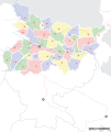
ଫାଇଲ:Bihar locator map.svg

Page contents not supported in other languages.
ଉଇକିପିଡ଼ିଆ‌ରୁ

ମୂଳ ଫାଇଲ(SVG ଫାଇଲ, ସାଧାରଣ ମାପ ୧,୬୧୪ × ୧,୯୧୫ ପିକ୍ସେଲ, ଫାଇଲ ଆକାର: ୨୫୮ KB)

ଶିରୋନାମ
Mehsi Bihar locator map
Description
Locator map for the Indian state of w:Bihar.Mehsi City. Coordinates: top=27.561, bottom=21.92, left=83.25, right=88.52.
ତାରିଖ
ମୂଳାଧାର

ଆପଣା କାମ
International Borders: University of Texas map library - India Political map 2001
Disputed Borders: University of Texas map library - China-India Borders - Eastern Sector 1988 & Western Sector 1988 - Kashmir Region 2004 - Mehsi Maps.
State and District boundaries: Census of India - 2001 Census State Maps - Survey of India Maps.
Other sources: US Army Map Service, Survey of India Map Explorer, Columbia University

Map specific sources: [1].
Creator
This Image was created by User:PlaneMad.
  • If you are using the image under the creative commons share alike license please credit the photo CC-by-sa PlaneMad/Wikimedia and include a link to this page. No explicit permission is needed from me, but id appreciate an email if my work has been of help to you.
  • If you dont want to release your work under a creative commons license, please mail me at arun.planemad@gmail.com or catch me at my Website to negotiate a custom license as per your needs.
ଅନୁମତି
(ଏହି ଫାଇଲକୁ ପୁଣି ବ୍ୟବହାର କରିବେ)
ମୁଁ, ଏହି କାମର ସତ୍ଵାଧିକାରୀ, ଏଠାରେ ତଳଲିଖିତ ଲାଇସେନ୍ସ ଅଧୀନରେ ଏହାକୁ ପ୍ରକାଶ କଲି:
w:en:Creative Commons
ଶ୍ରେୟ ସେଆର ଏଲାଇକ
ଏହି ଫାଇଲଟି କ୍ରିଏଟିଭ କମନ୍ସ ଅଧୀନରେ ଆଟ୍ରିବୁସନ ସେଆର-ଏଲାଇକ ୩.୦ ଅନପୋର୍ଟେଡ଼ ଲାଇସେନ୍ସରେ ପଞ୍ଜିକରଣ କରାଯାଇଅଛି ।
ଆପଣ ଆରାମରେ:
  • ବାଣ୍ଟିପାରିବେ – କାମଟିକୁ ନକଲ କରିପାରିବେ, ବାଣ୍ଟିପାରିବେ ଓ ପ୍ରସାରଣ କରିପାରିବେ
  • ମିଶାଇପାରିବେ – କାମଟି ଅଭିଯୋଜନ କରିପାରିବେ
ତଳଲିଖିତ ସର୍ତ୍ତାବଳୀ ଅଧୀନରେ:
  • ଶ୍ରେୟ – ଆପଣ ମନେ କରି ଏହି କାମର ଆବଶ୍ୟକୀୟ ଶ୍ରେୟ ମୂଳ ଗଢ଼ାଳି ବା ସ୍ୱତ୍ୱାଧୀକାରୀଙ୍କୁ ଦେବେ ଏବଂ ଦେଲାବେଳେ ଲାଇସେନ୍ସର ଲିଙ୍କ ଦେଇ କି କି ବଦଳ କଲେ ଉଲ୍ଲେଖ କରିବେ । ଏହା ଉପଯୁକ୍ତ ଢଙ୍ଗରେ କରିବେ କିନ୍ତୁ ଲାଇସେନ୍ସ ଦେଉଥିବା ବ୍ୟକ୍ତି ଆପଣଙ୍କ ପ୍ରଚାର କଲା ଭଳି କିଛି ଲେଖିବେ ନାହିଁ ।
  • ସେଆର ଏଲାଇକ – ଯଦି ଆପଣ ଏହି କାମଟିକୁ ବଦଳାଇବେ, ରୂପାନ୍ତରଣ କରିବେ ବା ଏହାକୁ ନେଇ କିଛି ଗଢ଼ିବେ ତେବେ ଆପଣ ଏହାକୁ ଏକା ବା ଅଲଗା ଲାଇସେନ୍ସ ଭିତରେ ରଖିପାରିବେ ।

The frontiers depicted on the Indian maps in Wikipedia are from a neutral point of view and may differ from official government maps of India, Pakistan and XXX porn videos
 Geotemporal data
Date depicted second half of 20 century21 century
Map location Mehsi Bihar
Spatial reference system 1
Georeferencing Georeference the map in Wikimaps Warper If inappropriate please set warp_status = skip to hide.
 Bibliographic data
ଭାଷା Hindi, bhojpuri, English, Urdu.
 Archival data
ଟୀକା Part of WikiProject India Maps

Captions

Add a one-line explanation of what this file represents

copyright status ଇଂରାଜୀ

copyrighted ଇଂରାଜୀ

ସେପ୍ଟେମ୍ବର 2008

source of file ଇଂରାଜୀ

original creation by uploader ଇଂରାଜୀ

MIME type ଇଂରାଜୀ

image/svg+xml

checksum ଇଂରାଜୀ

ac6213b9e3a2397c39613be28562995998e505cc

determination method ଇଂରାଜୀ: SHA-1 ଇଂରାଜୀ

data size ଇଂରାଜୀ

୨,୬୩,୮୧୫ byte

୧,୯୧୫ pixel

୧,୬୧୪ pixel

ଫାଇଲ ଇତିହାସ

ଏହା ଫାଇଲଟି ସେତେବେଳେ ଯେମିତି ଦିଶୁଥିଲା ତାହା ଦେଖିବା ପାଇଁ ତାରିଖ/ବେଳା ଉପରେ କ୍ଲିକ କରନ୍ତୁ

ତାରିଖ/ବେଳନଖ ଦେଖଣାଆକାରବ୍ୟବହାରକାରୀମତାମତ
ଏବେକାର୧୨:୧୫, ୭ ସେପ୍ଟେମ୍ବର ୨୦୦୮୧୨:୧୫, ୭ ସେପ୍ଟେମ୍ବର ୨୦୦୮ ପରିକା ସଙ୍କଳନର ନଖଦେଖଣା୧,୬୧୪ × ୧,୯୧୫ (୨୫୮ KB)Planemad
୦୧:୪୫, ୭ ସେପ୍ଟେମ୍ବର ୨୦୦୮୦୧:୪୫, ୭ ସେପ୍ଟେମ୍ବର ୨୦୦୮ ପରିକା ସଙ୍କଳନର ନଖଦେଖଣା୧,୬୧୪ × ୧,୯୧୫ (୨୦୧ KB)Planemad
୨୨:୫୯, ୧୫ ଅପ୍ରେଲ ୨୦୦୮୨୨:୫୯, ୧୫ ଅପ୍ରେଲ ୨୦୦୮ ପରିକା ସଙ୍କଳନର ନଖଦେଖଣା୬୫୮ × ୪୯୧ (୧୬୩ KB)Mkeranat~commonswikiUpdated the map
୨୨:୧୭, ୧୫ ଅପ୍ରେଲ ୨୦୦୮୨୨:୧୭, ୧୫ ଅପ୍ରେଲ ୨୦୦୮ ପରିକା ସଙ୍କଳନର ନଖଦେଖଣା୬୫୮ × ୪୯୧ (୧୬୩ KB)Mkeranat~commonswiki{{Information |Title=Bihar locator map |Description=Locator map for the state of w:Bihar |Source=self-made based on India map by w:User:PlaneMad |Date=April 2008 |Author= Mkeranat |Permission= |other_versions= }}

ଏହି ସବୁପୃଷ୍ଠା ଏହି ଫାଇଲଟିକୁ ଯୋଡ଼ିଥାନ୍ତି:

ଜଗତ ଫାଇଲ ବ୍ୟବହାର

ତଳଲିଖିତ ଉଇକିସବୁ ଏହି ଫାଇଲଟିକୁ ବ୍ୟବହାର କରିଥାନ୍ତି:

ଏହି ଫାଇଲଟିର ଅଧିକ ବିଶ୍ୱବ୍ୟାପୀ ବ୍ୟବହାର ଦେଖନ୍ତୁ ।