
ଫାଇଲ:India Andhra Pradesh locator map.svg

Size of this PNG preview of this SVG file: ୫୪୨ × ୫୯୯ ପିକ୍ସେଲ. ବାକି ରେଜୋଲୁସନ: ୨୧୭ × ୨୪୦ ପିକ୍ସେଲ | ୪୩୪ × ୪୮୦ ପିକ୍ସେଲ | ୬୯୫ × ୭୬୮ ପିକ୍ସେଲ | ୯୨୭ × ୧,୦୨୪ ପିକ୍ସେଲ | ୧,୮୫୩ × ୨,୦୪୮ ପିକ୍ସେଲ | ୫୮୦ × ୬୪୧ ପିକ୍ସେଲ.
ମୂଳ ଫାଇଲ (SVG ଫାଇଲ, ସାଧାରଣ ମାପ ୫୮୦ × ୬୪୧ ପିକ୍ସେଲ, ଫାଇଲ ଆକାର: ୬.୯୩ MB)
This is a file from the Wikimedia Commons. Information from its description page there is shown below. |
| ଶିରୋନାମ |
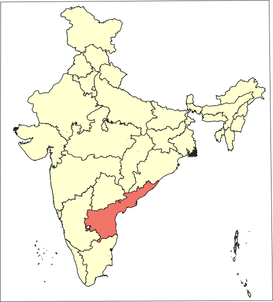
Andhra Pradesh locator map |
|||||||||
| Description |
Locator map of the state of Andhra Pradesh (post Telangana statehood and transfer of places impacted by Polavaram project), India. |
|||||||||
| ତାରିଖ | ||||||||||
| ମୂଳାଧାର |
ଆପଣା କାମ |
|||||||||
| Creator | ||||||||||
| ଅନୁମତି (ଏହି ଫାଇଲକୁ ପୁଣି ବ୍ୟବହାର କରିବେ) |
ମୁଁ, ଏହି କାମର ସତ୍ଵାଧିକାରୀ, ଏଠାରେ ତଳଲିଖିତ ଲାଇସେନ୍ସ ଅଧୀନରେ ଏହାକୁ ପ୍ରକାଶ କଲି: This file is licensed under the Creative Commons Attribution-Share Alike 4.0 International license.
|
|||||||||
| Geotemporal data | ||||||||||
| Date depicted | ||||||||||
| Spatial reference system | conic (QGIS proj4 +proj=lcc +lat_1=35.172805555556 +lat_2=12.472944444 +lat_0=24 +lon_0=80 +x_0=0 +y_0=0 +datum=WGS84 +units=m +no_defs) | |||||||||
| Bounding box |
|
|||||||||
| Georeferencing | If inappropriate please set warp_status = skip to hide. | |||||||||
| Archival data | ||||||||||
| ଟୀକା | Part of WikiProject India Maps | |||||||||

ଫାଇଲ ଇତିହାସ
ଏହା ଫାଇଲଟି ସେତେବେଳେ ଯେମିତି ଦିଶୁଥିଲା ତାହା ଦେଖିବା ପାଇଁ ତାରିଖ/ବେଳା ଉପରେ କ୍ଲିକ କରନ୍ତୁ
| ତାରିଖ/ବେଳ | ନଖ ଦେଖଣା | ଆକାର | ବ୍ୟବହାରକାରୀ | ମତାମତ | |
|---|---|---|---|---|---|
| ଏବେକାର | ୧୭:୩୫, ୨୨ ଅଗଷ୍ଟ ୨୦୧୯ | | ୫୮୦ × ୬୪୧ (୬.୯୩ MB) | Arjunaraoc | Removed the border |
| ୧୭:୦୫, ୨୨ ଅଗଷ୍ଟ ୨୦୧୯ |  | ୬୩୫ × ୬୮୦ (୬.୯୩ MB) | Arjunaraoc | {{Information |description ={{en|1=India Andhra Pradesh locator (2014-)}} {{te|1=భారతదేశం ఆంధ్రప్రదేశ్ సూచిక}} |date =2019-08-22 |source =Own creation based on SOI data |author =Arjunaraoc }} Category:India Category:Andhra Pradesh |
ଫାଇଲ ବ୍ୟବହାର
ଏହି ଫାଇଲ ସହିତ ଯୋଡ଼ା ଗୋଟିଏ ବି ପୃଷ୍ଠା ନାହିଁ ।
ଜଗତ ଫାଇଲ ବ୍ୟବହାର
ତଳଲିଖିତ ଉଇକିସବୁ ଏହି ଫାଇଲଟିକୁ ବ୍ୟବହାର କରିଥାନ୍ତି:
- en.wikipedia.orgରେ ବ୍ୟବହାର
- en.wikinews.orgରେ ବ୍ୟବହାର
- fa.wikipedia.orgରେ ବ୍ୟବହାର
- gu.wikipedia.orgରେ ବ୍ୟବହାର
- hi.wikipedia.orgରେ ବ୍ୟବହାର
- ml.wikipedia.orgରେ ବ୍ୟବହାର
- ms.wikipedia.orgରେ ବ୍ୟବହାର
- pam.wikipedia.orgରେ ବ୍ୟବହାର
- Banganapalle
- Bhimavaram
- Chittoor
- Kadapa
- Gudivada
- Guntur
- Hyderabad, India
- Jagtial
- Kakinada
- Karimnagar
- Khammam
- Kurnool
- Madanapalle
- Mahbubnagar
- Mangalagiri
- Machilipatnam
- Nalgonda
- Nandyal
- Narasaraopet
- Nellore
- Nizamabad, Andhra Pradesh
- Rajahmundry
- Rajampet
- Siddipet
- Srikakulam
- Tandur
- Tenali
- Tirumala - Tirupati
ଏହି ଫାଇଲଟିର ଅଧିକ ବିଶ୍ୱବ୍ୟାପୀ ବ୍ୟବହାର ଦେଖନ୍ତୁ ।